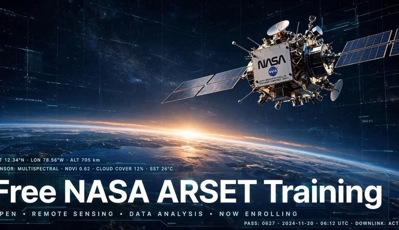
Free NASA ARSET training is one of the best-kept secrets in remote sensing education: NASA itself teaches you how to work with real satellite data — live, online, and completely free. ARSET, NASA’s Applied Remote Sensing Education and Training program, runs short courses on everything from flood mapping to air-quality analysis, using the same Earth-observation data scientists rely on every day.
If you are a GIS student, a researcher, or a working professional who wants hands-on satellite-data skills without paying for a bootcamp, this guide walks you through what ARSET offers, the current 2026 training lineup, and how to enroll for free.
Why NASA ARSET Training Is Worth Your Time
Most paid GIS courses teach you a software package. ARSET teaches you the data itself: how satellites measure the Earth, which sensors see which phenomena, and how to turn raw imagery into maps that answer real questions — for example, how bad is the air quality over my city today? or where did the floodwater spread? The instructors are NASA scientists and application specialists, the datasets are free NASA Earthdata, and the whole thing costs you nothing.
What Exactly Is ARSET?
ARSET is NASA’s Applied Remote Sensing Education and Training program. It was created to close the gap between NASA’s enormous free satellite-data archive and the people who could use it — disaster managers, health agencies, farmers, conservation groups, and students like you. Trainings are built around decision-making: every lesson ties a satellite product to a real application, from wildfire risk to crop monitoring. According to NASA, trainings are available “for all levels of experience at no cost,” from absolute beginner introductions to coding-based workshops in R and Python.
Training Formats: Live Online, Self-Paced, and Certificates
ARSET offers three ways to learn. Live online trainings run over a few days with real instructors, demos, and Q&A — most are scheduled in two to four sessions across a week. Self-paced courses on the ARSET learning management system let you learn anytime; the entry-level Fundamentals of Remote Sensing series is always available, and popular webinars like Hyperspectral Data for Land and Coastal Systems have been converted into self-paced courses you can complete on your own schedule. Many trainings include a certificate of completion — check each training’s page for the certificate details.
Topics You Can Study (All Free)
The catalog covers the full range of remote sensing applications: air quality and public health (including new TEMPO aerosol products), disasters and flood monitoring with NISAR radar data, agriculture and food security (crop mapping, soil moisture), climate resilience, water resources, ecological conservation, and wildland fires. If your interest is imagery and land analysis, pair ARSET with our guide to the top remote sensing software for efficient data analysis so you have both the skills and the tools.
Current ARSET Trainings on the Schedule
NASA keeps the training calendar updated on its Earthdata portal. Featured trainings listed this month include an air-quality session on TEMPO aerosol products using NOAA’s AerosolWatch (October 13–15), a flood and surface-water session using NISAR SAR and OPERA products (October 20–27), and a ground-movement session using NISAR InSAR data (November 12–19). The calendar rotates constantly — new disaster, agriculture, and climate sessions appear every few weeks — so check the official listing rather than waiting for a fixed semester.
How to Enroll in Free NASA ARSET Training
Enrollment is straightforward and takes a few minutes:
- Browse the training catalog on NASA’s Earthdata ARSET page and pick a training at your level.
- Register for the live sessions (each training page has a registration form — seats for the live webinars are free).
- Create a free ARSET learning management system account if you want the self-paced courses — you’ll be prompted during your first self-paced enrollment.
- Join the mailing list so you never miss a new training: send an email with no subject line to
arset-join@lists.nasa.govand follow the reply instructions.
You don’t need to be a US citizen, a university student, or an ArcGIS license holder — ARSET is open to the public worldwide. If you’re just starting out, read our QGIS tutorial for beginners alongside the Fundamentals of Remote Sensing series; the two together give you a free, complete remote-sensing workflow on free GIS software.
Frequently Asked Questions
Is NASA ARSET training really free?
Yes. ARSET is a NASA-funded program, so every training is free by design — live webinars, self-paced courses, recordings, and course materials all cost nothing, and there is no paywall or trial period.
Do I need to be a student or US citizen to join?
No. ARSET trainings are open to the public worldwide, at all experience levels. You only need an internet connection; some self-paced courses ask you to create a free learning-management account.
Do I get a certificate from ARSET training?
Many trainings include a certificate of completion when you finish the sessions or the self-paced modules. The certificate policy is listed on each training’s page, so check before you enroll if the certificate matters to you.
What skill level do ARSET trainings assume?
The catalog spans all levels: beginner-friendly courses like Fundamentals of Remote Sensing assume no prior knowledge, while advanced sessions use R or Python for classification and time-series analysis. Each training page lists prerequisites.
What software do I need for the hands-on exercises?
Most exercises use free web tools, QGIS, R, or Python — you won’t be asked to buy commercial software. A handful of advanced sessions mention ArcGIS workflows; our Learn ArcGIS free lessons guide covers free ArcGIS access for those.
How do I stay updated on new ARSET trainings?
Join the ARSET mailing list by emailing arset-join@lists.nasa.gov with an empty subject line, or bookmark the training catalog page on NASA Earthdata — new sessions are added every few weeks.
Conclusion: Free NASA ARSET training gives you something no generic online course can — direct instruction from the people who build and fly the satellites, on the actual data those satellites collect. Whether you want a career skill, a certificate, or just the ability to map floods and air quality yourself, start with the Fundamentals of Remote Sensing series and one live training this month. It costs nothing, and the skills compound fast.
Related posts: Top Remote Sensing Software for Efficient Data Analysis | QGIS Tutorial for Beginners | Free GIS Software for Mac | Learn ArcGIS Free: Official Lessons Guide
Disclosure: Some links on this page are affiliate links. If you buy a book through them, CartoGeek may earn a small commission at no extra cost to you. This helps keep our GIS guides free for students. Thank you for your support!
Recommended Remote Sensing Books

Introductory Digital Image Processing: A Remote Sensing Perspective (4th Edition)
by John R. Jensen
The standard university textbook on digital image processing of satellite and aerial imagery, covering how to extract biophysical information from remote sensor data. Extensively illustrated with a substantive reference list in every chapter for students starting research projects.
Pros:
- The definitive textbook — used in remote sensing courses worldwide
- Deep coverage from theory to analytical methods
- Strong reference lists for further study
Cons:
- Expensive textbook pricing
- Heavy on theory — not a software click-by-click guide

Remote Sensing and Image Interpretation (7th Edition)
by Thomas Lillesand, Ralph W. Kiefer, Jonathan W. Chipman
A discipline-neutral classic for introductory remote sensing and image interpretation courses, valued by GIS students and practitioners alike. Clear explanations of technical concepts with color imagery placed to support learning.
Pros:
- Trusted classic — decades of classroom use
- Discipline-neutral, suits geography, forestry, planning and more
- Good as both textbook and professional reference
Cons:
- Print quality varies by printing
- Some digital editions have limited e-reader compatibility