Finding free GIS software for Mac is easier than most students think. You do not need an expensive license to learn mapping, spatial analysis, or remote sensing on a MacBook.
Several professional tools run natively on macOS. The best ones work on both Apple Silicon (M1, M2, M3) and older Intel Macs, and they are the same programs recommended in university labs across the US.
This guide compares the best free GIS software for Mac, shows you how to install each one, and answers the Mac-specific questions students ask most.
Free GIS Software for Mac: The Complete Guide
1. QGIS — The Best Free GIS Software for Mac
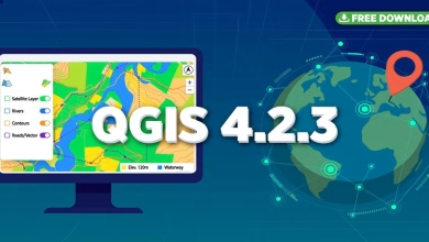
QGIS is the most popular free desktop GIS in the world, and it runs natively on macOS. It handles vector editing, raster analysis, 3D views, map layouts, and Python scripting in one program.
It is the top pick for students for three reasons. It is free forever with no trial limits. Its plugin library adds hundreds of extra tools. And its interface matches the Windows version, so every QGIS tutorial online works for you too.
How to install QGIS on Mac: download the macOS installer from the official QGIS download page. Open the DMG file and drag QGIS into your Applications folder. On the first launch, right-click the app and choose Open — this passes macOS Gatekeeper security in one step.
Current QGIS installers support Apple Silicon natively, so M1, M2, and M3 Macs run it at full speed. Older Intel builds still work through Rosetta 2 if you ever need them.
2. GRASS GIS — For Serious Spatial Analysis
GRASS GIS is a powerhouse for raster processing, terrain analysis, hydrology, and geostatistics. Universities and government agencies around the world use it for environmental modeling.
It runs on macOS through official builds from the GRASS project. The interface is more technical than QGIS, so it suits students who want deeper analytical control. Many QGIS users also run GRASS tools from inside QGIS through the Processing toolbox.
Get it from the official GRASS GIS download page and follow the macOS install notes for your chip type.
3. Google Earth Pro — Free Satellite Views on Mac
Google Earth Pro is free and ships a native Mac app. It is perfect for quick visualization, measuring distances and areas, and exploring historical satellite imagery without a heavy install.
It will not replace a full GIS for analysis, but every Mac GIS student should have it. Download it from Google’s official Earth versions page and you are mapping in minutes.
4. More Free Options Worth Installing
SAGA GIS is strong in terrain analysis and hydrology, with macOS builds available for students who outgrow the basics.
gvSIG offers 2D and 3D GIS with multilingual support, useful for urban planning and cadastre coursework.
GeoDa is a free, Mac-friendly tool for spatial statistics and exploratory data analysis — ideal for statistics-heavy GIS classes.
Start with QGIS and add the others only when a class or project needs them. One solid tool beats five half-installed ones.
5. Installing GIS Software on Apple Silicon Macs
Most current GIS tools ship native Apple Silicon builds, so M1, M2, and M3 Macs need no special steps. Download the macOS installer — never the Windows one — and check that it lists your macOS version as supported.
If an older tool warns about compatibility, macOS runs it through Rosetta 2 automatically on first launch. You approve it once, and it behaves like a native app afterward.
Keep macOS updated. GIS installers target recent macOS releases, and an old system version is the most common cause of failed installs on student MacBooks.
6. System Requirements for GIS on Mac
| Component | Recommended |
|---|---|
| macOS version | macOS 12 Monterey or newer |
| Chip | Apple Silicon (M1/M2/M3) or Intel 64-bit |
| RAM | 8 GB minimum; 16 GB recommended for large rasters |
| Storage | 4 GB free for apps plus room for datasets |
| Display | Any Retina display; an external monitor helps with map layouts |
| Internet | Needed for downloads and plugin installs only |
7. What US University Labs Use
US universities publish Mac GIS setup guides because so many students bring MacBooks to class. Stanford, UNC Chapel Hill, and Vanderbilt all maintain pages showing students how to run QGIS and GRASS on macOS.
Many labs standardize on QGIS for a simple reason: one free installer covers Mac, Windows, and Linux. A Mac user follows the exact same steps as everyone else, which keeps lab sessions and tutorials consistent.
If your course lists ArcGIS, check your university’s IT software portal first. Many US campuses include Esri education licenses for enrolled students — but for learning core GIS skills, the free tools above cover the same ground.
Download QGIS for Mac — Free Official Link
More official links: GRASS GIS · Google Earth Pro
Free GIS Software for Mac FAQs
Is QGIS really free for Mac?
Yes. QGIS is completely free and open source on macOS. There is no trial period, no watermark, and no paid tier — the Mac version has every feature the Windows version has.
Does ArcGIS run on Mac?
ArcGIS Pro is Windows-only and has no native Mac version. Mac users access Esri tools through ArcGIS Online in a browser, or run ArcGIS Pro in a virtual machine on Intel Macs. Most students simply use QGIS instead.
Which free GIS software is best for Mac students?
QGIS. It has the largest community, the most tutorials, native Apple Silicon support, and it runs the same on Mac, Windows, and Linux — so class instructions always match your screen.
Do these tools work on M1, M2, and M3 Macs?
Yes. QGIS and Google Earth Pro run natively on Apple Silicon. If you ever install an older Intel-only build, macOS translates it automatically with Rosetta 2.
Can US students get ArcGIS for free?
Many US universities provide Esri education licenses through their campus IT portal for enrolled students. Check your university’s software page or the Esri education program — but the free tools in this guide cover most coursework on their own.
How much RAM does GIS need on a Mac?
8 GB handles learning projects comfortably. Choose 16 GB if you plan to work with large satellite images or LiDAR point clouds.
Starting with free GIS software on a Mac costs nothing and takes under an hour. Install QGIS first, add Google Earth Pro for quick visualization, and keep GRASS GIS ready for heavy analysis. These are the same free tools US university labs recommend, and they run natively on both Apple Silicon and Intel Macs. Pick one, open a sample dataset, and start mapping today.
Related posts: QGIS Download for Windows and Mac · GIS Computer Requirements for Software · 12 Best Free GIS Software Tools for Students
Disclosure: Some links on this page are affiliate links. If you buy a book through them, CartoGeek may earn a small commission at no extra cost to you. This helps keep our GIS guides free for students. Thank you for your support!
Recommended GIS Books
Learn QGIS: Techniques for Efficient Spatial Analysis (5th Edition)
by Eugenia Sarafova, Ivan Ivanov, Andrew Cutts, Anita Graser
The most current beginner-to-intermediate QGIS book, covering spatial analysis, cartography, field data collection and earth observation workflows with real-world examples. Written with input from Anita Graser, a well-known QGIS community figure, it walks readers from first install to confident analysis.
Pros:
- Up to date with recent QGIS versions
- Hands-on, exercise-driven teaching style
- Covers modern topics like GenAI tools and mobile data collection
Cons:
- Moves fast for absolute beginners with zero GIS background
- Some advanced chapters assume basic statistics knowledge

QGIS Quick Start Guide: A Beginner’s Guide to Getting Started with QGIS
by Andrew Cutts
A short, beginner-friendly entry point to QGIS that steps through loading data, creating vector layers, styling, labeling and building your first maps. Its narrative style builds confidence quickly for readers who want results in a weekend.
Pros:
- Short and approachable — no 800-page intimidation
- Clear step-by-step instructions
- Good first book before tackling heavier texts
Cons:
- Based on an older QGIS version, so some screenshots differ
- Light on advanced analysis topics
Making Maps: A Visual Guide to Map Design for GIS (4th Edition)
by John Krygier
A beautifully illustrated, playful guide to cartographic design — from map layout and color to typography and visual storytelling. The newest edition adds coverage of data aggregation, AI in mapping and modern map-making workflows.
Pros:
- The most enjoyable cartography book to read — visual and witty
- Teaches design thinking, not just button-clicking
- Companion website with map examples
Cons:
- Design-focused — not a GIS software manual
- Philosophical tone isn’t for everyone