Mergin Maps download is the fastest way to take your QGIS projects out of the office and into the field. It is a free mobile GIS app built on open-source QGIS that lets you collect, store and synchronise field data with your team — no paper notes, no manual GPS coordinate entry.
The platform has three parts that work together: the Mergin Maps mobile app, the Mergin Maps Cloud, and the Mergin Maps QGIS plugin. You design your survey project in QGIS, upload it to the cloud, download it on your phone, collect points, lines and polygons in the field, then sync everything back to your desktop.
This guide shows you how to download Mergin Maps on Android, iOS and Windows, create your free account, connect QGIS, and run your first field survey. The latest version is 2026.4.1 (updated 9 October 2026), so the steps below match the current app exactly.
Mergin Maps Download and Setup Guide
Step 1: Create Your Free Mergin Maps Account
Creating an individual account on Mergin Maps is free. You need an account plus a workspace to store your projects. The cloud workspace starts with a free trial, and if you want to run your own server, there is a free Community Edition you can install yourself.
Sign up at the official Mergin Maps signup documentation and create your workspace. Your login works on the mobile app, the cloud and the QGIS plugin, so keep your credentials handy.
Step 2: Download the Mergin Maps Mobile App
The mobile app is free on every major platform. Pick your device:
- Android: get it from Google Play — Mergin Maps: QGIS in pocket. Requires Android 9.0 or newer.
- iPhone / iPad: get it from the App Store — Mergin Maps (Input).
- Windows: grab the latest desktop release from the official repo — Mergin Maps releases.
Open the app and sign in with the account you just created. You will see an empty project list — that is normal, because your survey project is built in QGIS first.
Step 3: Install the Mergin Maps QGIS Plugin
In QGIS, open the Plugin Manager and search for “Mergin Maps”. Install it and restart QGIS. The plugin adds a browser panel where you sign in to your workspace. Once connected, you can create a new Mergin Maps project directly from QGIS and push your current project to the cloud with one click.
Step 4: Build and Sync Your First Survey Project
Design your project in QGIS the way you normally would: add layers, set symbology, and create input forms for the fields you want to record. The map layers look the same on your phone as they do in QGIS desktop, so set your styling carefully.
Then click “Create Mergin Maps project” in the plugin, give it a name, and upload it. On your phone, open the app, refresh the project list, and download the project. Your survey is now ready for the field — with or without internet.
Step 5: Collect Data in the Field
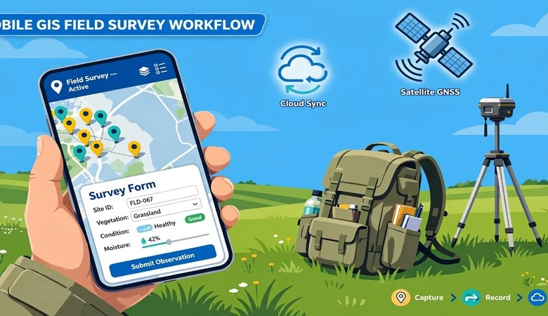
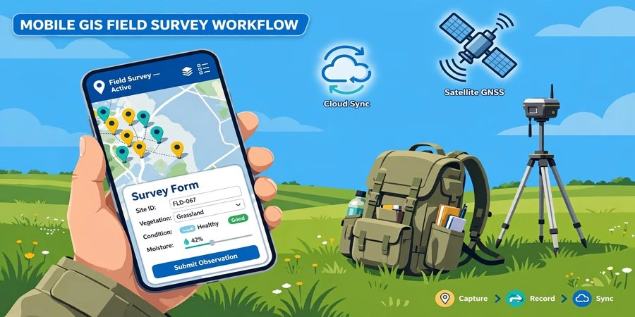
With the project open on your phone, tap “Record” and choose whether you are capturing a point, line or polygon. The app records your GPS position, you fill out the survey form, and you can attach photos. External GPS/GNSS receivers can be connected via Bluetooth for high-precision surveying.
Mergin Maps supports offline field data capture, so remote areas without signal are no problem. When you are back online, hit Sync — your data uploads to the cloud, and any changes your teammates made download to your device so everyone stays on the same version.
System Requirements
| Component | Requirement |
|---|---|
| Android app | Android 9.0 or newer, GPS recommended |
| iOS app | iPhone or iPad (recent iOS versions) |
| Windows app | Windows 10/11, 64-bit |
| QGIS plugin | QGIS 3.x or newer |
| Account | Free individual account + workspace (free trial; free Community Edition for self-hosting) |
| Internet | Only needed for sign-in and syncing — field capture works fully offline |
Mergin Maps vs QField: Which One Should You Use?
Both are free mobile GIS apps, but they solve the problem differently. Mergin Maps adds a managed cloud with automatic version history and team collaboration — two people can edit the same project without overwriting each other. QField syncs through cables or QFieldCloud instead. If you need cloud teamwork with conflict-free syncing, Mergin Maps is the simpler choice; for single-user offline surveys, both work well.
Download Mergin Maps — Free Official Links
Download for Android
Download for iPhone
Download for Windows
Mergin Maps Download FAQs
Is Mergin Maps really free to download?
Yes. The mobile app and the QGIS plugin are completely free and open source. Individual accounts are free too; the cloud workspace starts with a free trial, and a free Community Edition exists for self-hosting.
Does Mergin Maps work without internet?
Yes. Offline field data capture is fully supported. You only need internet to sign in, download the project, and sync your collected data back to the cloud.
Which platforms does Mergin Maps support?
Android (9.0+), iOS (iPhone/iPad) and Windows. The QGIS plugin works with QGIS 3.x and newer on all desktop platforms.
How do I get my QGIS project onto my phone?
Install the Mergin Maps QGIS plugin, sign in, create a project from QGIS, upload it, then download that project inside the mobile app. Your layers and symbology carry over exactly.
Can I connect an external GPS device?
Yes. Mergin Maps supports external GPS/GNSS receivers over Bluetooth for high-precision surveying work.
What formats can I export my field data to?
CSV, Microsoft Excel, ESRI Shapefile, MapInfo, GeoPackage, PostGIS, AutoCAD DXF and KML — directly from your synced QGIS project.
Starting your field surveys with Mergin Maps takes about 30 minutes: one free account, one free app download, and the free QGIS plugin. Design the project once in QGIS and every member of your team collects consistent, geo-tagged data on their phones — even offline.
Related posts: QGIS Download for Windows and Mac · GIS Computer Requirements for Software · 12 Best Free GIS Software Tools for Students