An ERDAS IMAGINE free download for students is the cheapest way to learn professional remote sensing. ERDAS IMAGINE is the world’s most widely used remote sensing software, and a commercial license costs thousands of dollars. The good news: if you are enrolled at a US college or university, several official routes give you the full software free. This guide covers every one of them — your university’s site license, Hexagon’s education program, a certified training partner, and a UK student offer — plus install steps and system requirements.
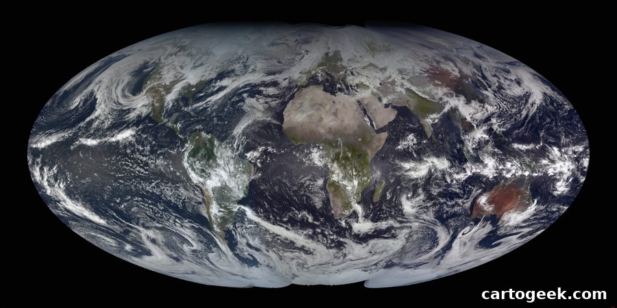
ERDAS IMAGINE Free Download for Students: Every Official Path
ERDAS IMAGINE, built by Hexagon Geospatial, turns satellite and aerial imagery into maps and analysis. It handles multispectral classification, hyperspectral processing, LiDAR point clouds, radar, and photogrammetry in one package. That is why remote sensing courses at US universities teach it, and why employers list it on job ads. Students do not need to buy it. Here are the four official ways to get it free.
Path 1 — Your University’s Site License (The Fastest Option)
Many US universities hold a Hexagon site license that covers ERDAS IMAGINE for enrolled students. Old Dominion University, for example, runs a site license with 26 instructional seats plus reserved faculty licenses, and it issues License Authentication Codes that let students generate free student licenses of their own. The University of Illinois has distributed ERDAS IMAGINE to students free through its campus WebStore. The pattern is the same everywhere. Sign in with your university credentials, search your school’s IT or software portal for “ERDAS” or “Hexagon”, and claim the license. If your department teaches remote sensing, ask your professor — they can usually request a seat for you.
Path 2 — Hexagon Geospatial U Education Program
Hexagon runs its own education program, called Hexagon Geospatial U, for universities and colleges. The desktop education bundle includes ERDAS IMAGINE Professional with its add-ons, IMAGINE Photogrammetry, and GeoMedia. The program also offers grants, certified training centers, and ready-made curriculum with step-by-step tutorials and example data that professors can use in class. Your university applies through Hexagon or a local Hexagon partner, and enrolled students then get licenses to practice on open remote sensing data. If your school does not have the program yet, forward the Hexagon education pages to your department head — that is how most schools join.
Path 3 — Free License Through a Certified Training Partner
Brilliant Remote Sensing Labs (BRS-Labs) is a certified Hexagon education partner that runs online ERDAS IMAGINE courses with certificates. Students enrolled in its courses receive a free ERDAS IMAGINE educational license for the duration of their study. The current version taught is ERDAS IMAGINE 2025 (version 16.9.0), and the license is activated with an Activation ID sent to your email. This route suits students whose own university has no site license. Enroll in a course, get the license, and learn with the same software your future employer uses.
Path 4 — UK Student Offer (One Full Year Free)
Students in the UK have one more route. The Geological Remote Sensing Group (GRSG) has an agreement with Hexagon that gives active GRSG student members free access to ERDAS IMAGINE for a full year, along with technical documentation and webinars. You register with your academic email and an enrolment certificate. The license is for study and project research, not commercial work. US students can check whether their own professional society — such as ASPRS — runs a similar student software benefit.
How to Install ERDAS IMAGINE as a Student
Once you have a license, installation takes about 20 minutes. Download the installer from the official Hexagon download portal, run it as administrator, and choose the IMAGINE Professional option. When the installer asks for licensing, enter the Activation ID from your university or training partner. Open the Hexagon Geospatial License Administration tool, paste the code, and click Next. Your license activates, and ERDAS IMAGINE opens with full Professional tools. If your Activation ID starts with “NL”, select the Node Locked Activation option in the licensing tool.
System Requirements for ERDAS IMAGINE
| Component | Minimum | Recommended |
|---|---|---|
| Operating system | Windows 10 64-bit | Windows 11 64-bit |
| Processor | Multi-core CPU | 8-core CPU or better |
| Memory (RAM) | 8 GB | 16 GB or more |
| Disk space | 10 GB free | SSD with 20 GB free |
| Graphics | Integrated graphics | Dedicated GPU for large imagery |
ERDAS IMAGINE runs on Windows only. Mac users can access it through their university’s virtual desktop environment, the same way Old Dominion University offers it through its Monarch Virtual Environment. Check the official release guide on the Hexagon site for the full requirements of your version.
What You Can Learn With the Free Student License
The student license is the full Professional edition, not a trial with missing tools. Start with image classification: load a free Landsat or Sentinel-2 scene and run a supervised classification. Then try the Spatial Modeler, which lets you chain processing steps into reusable recipes. Add a LiDAR point cloud to practice terrain analysis, and finish with a change-detection project — the exact portfolio piece that remote sensing employers ask about. For a step-by-step first project, pair this guide with our free satellite imagery download tutorial, which shows where to get Landsat and Sentinel data at no cost.
Free Alternatives If You Cannot Get a License
If none of the four paths work for you right now, do not wait. QGIS with the Orfeo ToolBox plugin, ESA SNAP, and GRASS GIS all process satellite imagery free, and our free remote sensing software guide covers them all. The concepts transfer directly: classification, band math, and mosaicking work the same way in ERDAS IMAGINE. Keep applying for the student license in parallel — the ERDAS name on your resume still matters for US government and defense remote sensing jobs.
Download ERDAS IMAGINE Free for Students
Frequently asked questions
Can students really get ERDAS IMAGINE for free?
Yes. Through your university’s Hexagon site license, the Hexagon Geospatial U education program, a certified training partner like BRS-Labs, or a student society offer such as the UK GRSG program. All four routes are official and free for enrolled students.
Which version do students get?
The current version is ERDAS IMAGINE 2025 (version 16.9.0), the full Professional edition with add-ons. Your university or training partner supplies the installer and the Activation ID.
How long does the free student license last?
It lasts for the duration of your study or course. University site licenses stay valid while you are enrolled. Training-partner licenses run for your course period and can be renewed for further courses. The UK GRSG offer lasts one full year.
Does ERDAS IMAGINE work on a Mac?
No. ERDAS IMAGINE runs on Windows only. Mac users can use their university’s virtual desktop environment, or run Windows through a virtual machine, to access it.
Can I use the student license for freelance or commercial work?
No. Student and education licenses are strictly for learning, coursework, and academic research. Commercial use requires a paid license.
What if my university does not offer ERDAS IMAGINE?
Ask your remote sensing professor to request it through the Hexagon education program, or enroll with a certified training partner that issues a free educational license during your course. Meanwhile, learn the same skills free in QGIS, SNAP, or GRASS GIS.
A free ERDAS IMAGINE student license is one of the best deals in remote sensing education. Start with your university’s software portal — it is the fastest and most complete option. If that fails, ask your professor about the Hexagon education program or enroll with a certified training partner. Between the site license, the education program, and the training route, no student needs to pay for ERDAS IMAGINE while learning. Pick your path above and start processing satellite imagery today.
Related posts: Free Remote Sensing Software Download · ArcGIS Student License Free · Free Satellite Imagery Download · Best GIS Software for Students
Disclosure: Some links on this page are affiliate links. If you buy a book through them, CartoGeek may earn a small commission at no extra cost to you. This helps keep our GIS guides free for students. Thank you for your support!
Recommended Remote Sensing Books

Introductory Digital Image Processing: A Remote Sensing Perspective (4th Edition)
by John R. Jensen
The standard university textbook on digital image processing of satellite and aerial imagery, covering how to extract biophysical information from remote sensor data. Extensively illustrated with a substantive reference list in every chapter for students starting research projects.
Pros:
- The definitive textbook — used in remote sensing courses worldwide
- Deep coverage from theory to analytical methods
- Strong reference lists for further study
Cons:
- Expensive textbook pricing
- Heavy on theory — not a software click-by-click guide