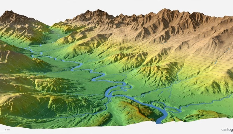
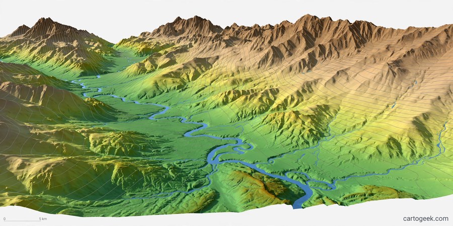
A free DEM download is the fastest way to start terrain analysis without spending a dollar. A DEM, or digital elevation model, is a raster where every cell holds a height. With one you can build hillshades, slope maps, watersheds, flood models, and 3D views in QGIS. This guide lists eight official sources where students can download elevation data free, with resolution, coverage, licence, and sign-in needs for each.
Every source below is official and free. Some need a free account, and some do not. Pick by your study area first, then by resolution. For most student projects, one global 30 m DEM is enough to start.
Free DEM Download Sources: 8 Official Options Compared
Before you download, know two terms. A DSM records the top of whatever is there, including trees and roofs. A DTM records the bare ground underneath. For flood and slope work under trees, a DTM is the right choice. For a first look at any place on Earth, a 30 m DSM is fine.
| Source | Resolution | Coverage | DSM / DTM | Account needed |
|---|---|---|---|---|
| Copernicus DEM GLO-30 | 30 m | Global | DSM | No |
| SRTM 1 arc-second | 30 m | 60°N to 56°S | DSM | Yes, NASA Earthdata |
| NASADEM | 30 m | 60°N to 56°S | DSM | No, via Planetary Computer |
| ALOS AW3D30 v4.1 | 30 m | Global | DSM | Yes, JAXA |
| ASTER GDEM v3 | 30 m | 83°N to 83°S | DSM | Yes, NASA Earthdata |
| USGS 3DEP | 1 m / 10 m | United States | DTM | No |
| OpenTopography | 30 m and finer | Global + LiDAR areas | Both | Yes, free API key |
| GEBCO_2026 | ~450 m | Global land + ocean | Terrain model | No |
1. Copernicus DEM GLO-30 — the best first download
Copernicus GLO-30 is a 30 m surface model built from TanDEM-X radar data collected from 2011 to 2015. It covers the whole world, and its public copy on AWS needs no account at all. If you need one DEM anywhere on Earth today, take this one. Download it from the official Copernicus Data Space: dataspace.copernicus.eu.
2. SRTM 1 arc-second — the classic 30 m baseline
The Shuttle Radar Topography Mission flew in February 2000 and still sets the baseline for global elevation. SRTM 1 arc-second gives 30 m data from 60°N to 56°S. Get it free from NASA Earthdata Search, which needs a free NASA account: search.earthdata.nasa.gov.
3. NASADEM — SRTM, reprocessed and improved
NASADEM reprocesses the original SRTM radar with better orbit data and fills voids using ASTER and ALOS data. If you were going to use SRTM, use NASADEM instead. It is the same 30 m resolution with cleaner heights. Browse it with no account on the Microsoft Planetary Computer: planetarycomputer.microsoft.com — NASADEM.
4. ALOS AW3D30 v4.1 — an independent 30 m check
ALOS World 3D-30m is a global 30 m surface model from JAXA optical stereo imagery. Version 4.1 is the current release, updated in April 2024. It is free for commercial and non-commercial use, and it makes a good independent check against SRTM-based models. A free JAXA registration is needed to download: eorc.jaxa.jp — ALOS AW3D30.
5. ASTER GDEM v3 — the widest latitude coverage
ASTER GDEM version 3 covers 83°N to 83°S, about 99% of Earth’s land. It is a 30 m optical-stereo product from 2000 to 2013. It has more gaps and noise than SRTM in cloudy areas, but it reaches further north and south than any other free 30 m DEM. Download it free from NASA Earthdata Search: search.earthdata.nasa.gov.
6. USGS 3DEP — 1 m bare ground for the United States
If your study area is in the United States, stop reading the global list. USGS 3DEP gives bare-earth terrain at 1 m where LiDAR was flown, plus a seamless 10 m product for the whole country. All 3DEP data is public domain. Download it free from USGS EarthExplorer: earthexplorer.usgs.gov.
7. OpenTopography — one portal for almost every global DEM
OpenTopography serves Copernicus, SRTM, NASADEM, ALOS, and the EU DTM bare-earth model of Europe through one API and one QGIS plugin. A free account and API key unlocks it. For students, this is the simplest route: one login, every major global DEM, plus LiDAR point clouds where available. Start at the official portal: opentopography.org.
8. GEBCO_2026 — the only one that covers the ocean floor
Every other source on this list stops at the coastline. GEBCO_2026 is a global terrain model for ocean and land at 15 arc-second resolution, about 450 m. It is public domain and updated every year. Use it for ocean bathymetry, coastal work, and global maps. Download it from the official GEBCO page: gebco.net — Gridded Bathymetry Data.
How to open a free DEM in QGIS
Download the GeoTIFF for your area, then open QGIS and use Layer > Add Layer > Add Raster Layer. Pick the file and click Add. To see terrain, right-click the layer, open Properties > Symbology, and switch the render type to Hillshade. For slope and aspect, use the Raster > Analysis tools. Our QGIS tutorial for beginners walks through the full setup if QGIS is new to you.
Which free DEM should you pick?
Pick by goal, not by brand. For a first project anywhere on Earth, take Copernicus GLO-30. For the United States, take USGS 3DEP. For flood or drainage work under trees in Europe, take the EU DTM through OpenTopography. For ocean or coastal work, take GEBCO. For a class assignment, any 30 m global DEM works, so take the one with the easiest download. Pair your DEM with free GIS data download sites for boundaries and roads, and with free satellite imagery for a base map.
Download Free DEM Data — Copernicus Data Space (Official)
Frequently asked questions
Is a free DEM download really free for students?
Yes. Every source on this list is free to download and use for study and research. Some ask for a free account first. None charges for the data itself.
What is the best free DEM for beginners?
Copernicus DEM GLO-30. It is 30 m, global, and needs no account. Download one tile for your area and open it in QGIS in minutes.
What is the difference between a DEM, DSM, and DTM?
A DEM is the general term for an elevation raster. A DSM records the top of trees and buildings. A DTM records the bare ground. For flood modeling, use a DTM. For 3D views, either works.
Which free DEM has the highest resolution?
USGS 3DEP at 1 m, but only for the United States where LiDAR was flown. Globally, the best free resolution is 30 m from Copernicus, SRTM, NASADEM, ALOS, and ASTER.
Can I use a free DEM in QGIS?
Yes. All of these sources deliver GeoTIFF files that QGIS opens directly. You can also stream the Copernicus DEM into QGIS from its public cloud copy without downloading the whole tile.
Do I need an account to download a free DEM?
Not always. Copernicus, USGS 3DEP, NASADEM on Planetary Computer, and GEBCO need no account. SRTM, ASTER, ALOS, and OpenTopography ask for a free registration or API key.
Free elevation data has never been easier to get. Start with Copernicus GLO-30 for a global first look, switch to USGS 3DEP or the EU DTM when your project needs bare ground, and add GEBCO when your map reaches the sea. Download one tile today, open it in QGIS, and make your first hillshade.
Related posts: Free GIS Data Download Sites · Free Satellite Imagery Download · SAGA GIS 9.14.2 Free Download · QGIS Tutorial for Beginners
Disclosure: Some links on this page are affiliate links. If you buy a book through them, CartoGeek may earn a small commission at no extra cost to you. This helps keep our GIS guides free for students. Thank you for your support!
Recommended GIS Learning Books
Learn QGIS: Techniques for Efficient Spatial Analysis (5th Edition)
by Eugenia Sarafova, Ivan Ivanov, Andrew Cutts, Anita Graser
The most current beginner-to-intermediate QGIS book, covering spatial analysis, cartography, field data collection and earth observation workflows with real-world examples. Written with input from Anita Graser, a well-known QGIS community figure, it walks readers from first install to confident analysis.
Pros:
- Up to date with recent QGIS versions
- Hands-on, exercise-driven teaching style
- Covers modern topics like GenAI tools and mobile data collection
Cons:
- Moves fast for absolute beginners with zero GIS background
- Some advanced chapters assume basic statistics knowledge
GIS Tutorial for ArcGIS Pro 3.4 (Esri Press)
by Wilpen L. Gorr, Kristen S. Kurland
A classroom-tested ArcGIS Pro workbook by two Carnegie Mellon instructors, with hands-on exercises and homework assignments that build real problem-solving skills. Written for both university courses and self-learners who want a rigorous primer.
Pros:
- Academic rigor — used in real university curricula
- Exercises reinforce each concept
- Instructor resources available for teachers
Cons:
- Denser and more demanding than casual guides
- Best paired with an instructor or study group
Learning Geospatial Analysis with Python (3rd Edition)
by Joel Lawhead
A systematic guide to GIS and remote sensing analysis with Python, covering geodatabases, raster data, PostGIS, QGIS integration and workflow automation. Readers build real analytical skills, from thematic mapping to flood modeling.
Pros:
- Bridges GIS and Python — the highest-demand skill combo
- Practical projects, not just theory
- Covers the open-source stack (GeoPandas-style workflows, PostGIS, QGIS)
Cons:
- Requires basic Python knowledge first
- Some library versions have moved on since publication