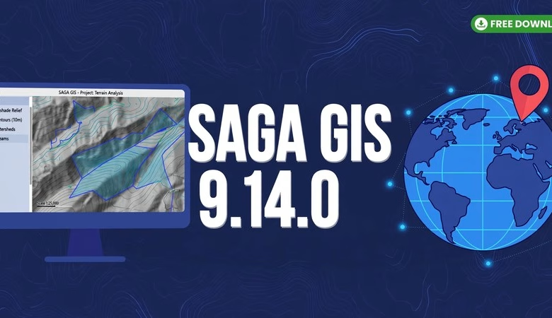
This SAGA GIS 9.14.0 free download guide gets you the newest release of the free, open-source GIS built for geoscientific work. SAGA GIS (System for Automated Geoscientific Analyses) is famous for one thing: terrain analysis from digital elevation models — slope, aspect, hillshade, watersheds, and flood modeling with zero license fees. Version 9.14.0 is the latest stable release, announced by the SAGA development team in October 2026, and it moves the SAGA GUI’s map rendering capabilities into the API so programmers can use them directly. Below you will find what’s new, step-by-step install instructions for Windows and Linux, system requirements, and answers to the most common questions.
SAGA GIS 9.14.0 Download: What’s New in This Release
SAGA 9.14.0 is the project’s newest release, announced on the official SAGA news page. Here are the highlights that matter most for students and GIS users.
Map rendering moves into the API
The headline change: efforts went into moving SAGA GUI’s map rendering capabilities to the API, making them directly accessible for programming. If you script your workflows — automating map production, generating figures for papers, or building batch pipelines — you can now drive SAGA’s map rendering from code instead of clicking through the GUI. That is a big deal for reproducible geoscientific analysis.
New mapping functions and Jupyter Notebook example
Supplemented by a few additional functions, the updated Jupyter Notebook example is the recommended starting point for exploiting the new mapping functions through PySAGA. Students who know a little Python can now load data, run modules, and render maps inside a notebook — a workflow that pairs nicely with QGIS or a plain raster stack.
Built on the 9.13 line’s improvements
SAGA 9.14.0 follows the 9.13 releases, which brought an easy-to-use downloader for SoilGrids data and a continuation for the SAGA NextGen QGIS provider plugin (the one that broke earlier this year). So 9.14.0 arrives on top of better soil-data access and a working QGIS bridge — nice context if you are upgrading from 9.7 or 9.12.
The 450-module core stays intact
Everything SAGA is known for is still here: morphometry (slope, aspect, curvature), hydrology (flow accumulation, catchments, channel networks), illumination (hillshade, visibility), geostatistics (Kriging, variograms), image analysis, grid interpolation, and vector tools. If you are coming from the 9.7.0 guide, all your modules and DEM workflows carry over.
How to download and install SAGA GIS 9.14.0 on Windows
The easiest path on Windows is the portable zip from the official SourceForge files page — SAGA needs no installer. Go to the official download site, open the Files section, and download the saga-x64 zip for the 9.14.0 release. Unzip the folder anywhere, open it, and double-click saga_gui.exe. That is the whole installation — no admin rights needed, and it even runs from a USB drive.
How to install SAGA GIS 9.14.0 on Linux and macOS
On Ubuntu or Debian, install from your distribution’s repository or grab the build for your distro from the SourceForge Files page. A linux tarball is published for each release. macOS users can download the macOS app bundle (marked experimental) from the same Files page. After launching, run saga_gui or open it from your app menu to verify it starts.
System requirements
| Requirement | Detail |
|---|---|
| Operating system | 64-bit Windows 10/11, Ubuntu 20.04+ or other recent Linux, macOS (bundle available) |
| Disk space | ~300 MB for the program, 2 GB+ free for DEMs and outputs |
| Memory (RAM) | 2 GB minimum, 8 GB or more for large LiDAR and DEM datasets |
| Processor | Any dual-core; quad-core speeds up module runs |
| Programming (optional) | Python 3 for PySAGA and the Jupyter Notebook mapping example |
Frequently asked questions
Is SAGA GIS 9.14.0 really free?
Yes. SAGA GIS is fully open-source under the GPL. There is no paid version, no trial, and no locked features — 9.14.0 costs nothing for students, researchers, or businesses.
What is new in SAGA GIS 9.14.0?
The GUI’s map rendering capabilities moved into the API, so you can now render maps from code — plus new mapping functions and an updated Jupyter Notebook example showing how to use them through PySAGA.
Do I need to install SAGA GIS?
Not on Windows — it is portable. Unzip the x64 folder and run saga_gui.exe. Linux users install it from their distro’s repository or the SourceForge files page.
Can I use SAGA GIS with QGIS?
Yes. QGIS includes SAGA algorithms in its Processing Toolbox, and both read the same GeoTIFF, shapefile, and grid formats. Many students preprocess terrain in SAGA and make final layouts in QGIS.
What is SAGA GIS used for?
Terrain analysis is its strength: slope, aspect, hillshade, watersheds, and flood or erosion modeling from elevation data. It also covers geostatistics, image analysis, and general geoprocessing — over 450 modules.
Should I upgrade from 9.7.0 or 9.13.x?
If you script maps or notebooks, yes — 9.14.0’s mapping API is the reason to upgrade. For GUI-only terrain analysis, 9.13.x is close, but the latest stable is always the safest bet for new projects.
SAGA GIS 9.14.0 keeps the program moving forward: map rendering you can drive from code, fresh Jupyter and PySAGA examples, and the same 450-module terrain powerhouse behind it. It installs in minutes on Windows and Linux, and it costs nothing. If your GIS work touches elevation data, this is one upgrade worth making today.
Related posts: GRASS GIS Software Download · QGIS Download for Windows, MacOS and Linux · 20 Best GIS Software Applications with Download Link
Disclosure: Some links on this page are affiliate links. If you buy a book through them, CartoGeek may earn a small commission at no extra cost to you. This helps keep our GIS guides free for students. Thank you for your support!
Recommended GIS Books
Learn QGIS: Techniques for Efficient Spatial Analysis (5th Edition)
by Eugenia Sarafova, Ivan Ivanov, Andrew Cutts, Anita Graser
The most current beginner-to-intermediate QGIS book, covering spatial analysis, cartography, field data collection and earth observation workflows with real-world examples. Written with input from Anita Graser, a well-known QGIS community figure, it walks readers from first install to confident analysis.
Pros:
- Up to date with recent QGIS versions
- Hands-on, exercise-driven teaching style
- Covers modern topics like GenAI tools and mobile data collection
Cons:
- Moves fast for absolute beginners with zero GIS background
- Some advanced chapters assume basic statistics knowledge