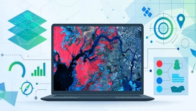
How AI Enhances GIS: Smarter Geospatial Analysis
Discover how AI is revolutionizing GIS by enhancing data accuracy, automating processes, and enabling real-time geospatial insights. Learn about machine learning, deep learning, and predictive analytics in GIS applications.
AI in GIS Understanding the Intersection of AI and GIS
In today’s rapidly advancing technological landscape, the fusion of Artificial Intelligence (AI) with Geographic Information Systems (GIS) is revolutionizing how we interpret and analyze spatial data. This powerful integration—commonly referred to as GeoAI (Geospatial Artificial Intelligence)—leverages machine learning, deep learning, and other AI techniques to enhance traditional GIS capabilities.

GIS has long been a fundamental tool for spatial data visualization, mapping, and geospatial analysis. However, traditional GIS methods require significant human intervention and manual data processing. The introduction of AI-driven algorithms has transformed this landscape, enabling automation in GIS mapping, real-time data analysis, and predictive modeling. These advancements are reshaping industries, from urban planning and agriculture to disaster management and public health.
This article explores how AI-powered GIS is shaping the future of geospatial intelligence, its core functionalities, real-world applications, challenges, and the future direction of this emerging field.
What is GIS?
Before diving into how AI enhances GIS, it’s important to understand what GIS is and why it is so essential.
A Geographic Information System (GIS) is a framework that allows users to capture, store, analyze, and visualize spatial and geographic data. It enables professionals to map and interpret data patterns that are tied to locations. GIS is widely used in fields such as environmental monitoring, transportation, urban planning, and public safety.
Core Functions of GIS Include:
- Data Collection and Storage – GIS stores large volumes of geospatial data from satellites, sensors, and field surveys.
- Mapping and Visualization – It allows users to create interactive maps and 3D models for better spatial understanding.
- Spatial Analysis – GIS software can analyze relationships, patterns, and trends in geographic data.
- Decision Support Systems – Governments, businesses, and organizations use GIS to make data-driven decisions in planning and development.
Despite its effectiveness, traditional GIS has limitations in handling large datasets, automating tasks, and making predictive analyses. This is where AI comes in.
Download ERDAS IMAGINE 2022 Free
How AI is Transforming GIS
Artificial Intelligence (AI) in GIS enhances traditional methods by automating complex tasks, improving accuracy, and unlocking new capabilities. AI-powered GIS systems can process massive datasets, detect patterns, and provide actionable insights with minimal human intervention.
Key Advancements AI Brings to GIS:
- AI-Powered Spatial Data Processing – AI can quickly process geospatial big data, making sense of satellite images, sensor data, and aerial photographs.
- Predictive Analytics in GIS – AI algorithms predict natural disasters, climate change trends, and urban expansion by analyzing past data.
- Automation in Cartography – AI-driven tools streamline the creation of digital maps, reducing the need for manual mapping efforts.
- Remote Sensing AI Applications – AI enhances satellite image classification, land cover detection, and vegetation monitoring.
- Improved Spatial Accuracy – Machine learning models correct errors in geographic coordinates, elevation data, and boundary definitions.
By integrating AI, GIS is evolving into a smarter, more efficient system that is capable of tackling complex geospatial challenges with greater speed and precision.
Key Industries Benefiting from AI-Driven GIS
The synergy of AI and GIS is transforming various industries, enhancing productivity, and enabling smarter decision-making. Some of the most significant beneficiaries include:
1. Urban Planning and Smart Cities
AI-powered GIS is revolutionizing how cities plan infrastructure, optimize traffic flow, and manage public services. Governments use geospatial AI to:
- Predict population growth patterns and design sustainable urban developments.
- Monitor air quality and environmental changes for better city planning.
- Enhance real-time traffic management using AI-powered geospatial models.

2. Agriculture and Precision Farming
AI-driven GIS plays a crucial role in precision agriculture, helping farmers optimize crop yields, irrigation, and pest control.
- Machine learning models analyze satellite imagery to detect soil conditions and predict harvest times.
- AI-powered drones monitor crop health, reducing waste and improving productivity.
- Geospatial AI assists in climate modeling, helping farmers adapt to changing weather conditions.
3. Disaster Management and Risk Assessment
AI-enhanced GIS is a game-changer for disaster prediction, response, and recovery. It helps in:
- Predicting natural disasters such as earthquakes, hurricanes, and floods.
- Mapping high-risk zones and developing early warning systems.
- Analyzing post-disaster damage assessments using satellite imagery and AI pattern recognition.
4. Environmental Monitoring and Conservation
With climate change accelerating, AI-powered GIS is being used to track deforestation, water pollution, and wildlife movements.
- Remote sensing AI detects environmental hazards in real-time.
- AI models predict ecosystem changes and recommend conservation strategies.
- Geospatial intelligence aids in sustainable land-use planning and natural resource management.
5. Public Health and Epidemiology
During health crises like the COVID-19 pandemic, AI-driven GIS played a crucial role in tracking infection spread and allocating medical resources.
- Spatial AI predicts disease outbreaks by analyzing mobility data and environmental factors.
- AI-enhanced GIS assists in hospital location planning and optimizing healthcare services.
- Geospatial analytics improve vaccine distribution efficiency in remote areas.
6. Defense and Security
National security agencies use AI-powered GIS for border surveillance, threat detection, and tactical planning.
- AI in geospatial intelligence detects unauthorized activities in real-time.
- Predictive modeling assists in counter-terrorism operations and resource deployment.
- Machine learning algorithms process satellite images for defense strategies.
Challenges in AI-Powered GIS
Despite its numerous advantages, integrating AI into GIS comes with its own set of challenges.
1. Data Quality and Accuracy Issues
- AI models rely on vast amounts of data, and errors in spatial data can lead to incorrect predictions.
- Ensuring high-quality, well-annotated datasets is critical for AI to function accurately.
2. Computational and Infrastructure Demands
- AI-based GIS applications require high computational power and storage.
- Smaller organizations may struggle with cloud infrastructure costs needed for AI-driven geospatial analysis.
3. Ethical and Privacy Concerns
- AI-powered GIS collects sensitive location data, raising privacy concerns.
- Ethical questions arise regarding the misuse of geospatial intelligence for surveillance and data tracking.
4. Skill Gaps in AI and GIS
- Many professionals lack expertise in AI-driven GIS, creating a demand for specialized training.
- Universities and research institutions are working to bridge the gap through GeoAI courses and certifications.
The Future of AI in GIS
The future of AI-powered GIS looks promising, with ongoing advancements shaping the next generation of geospatial intelligence.

Emerging Trends in AI and GIS:
- Real-Time Geospatial Decision Support Systems – AI will enable faster, data-driven decision-making for governments and businesses.
- AI-Powered 3D GIS Models – The development of 3D geospatial simulations will enhance urban planning and environmental monitoring.
- Quantum Computing in Geospatial Analysis – Future AI-GIS systems may leverage quantum computing for ultra-fast spatial data processing.
- Edge Computing in Geospatial AI – AI models will process data closer to the source (satellites, sensors, and IoT devices) for real-time insights.
How AI Enhances GIS Capabilities
The integration of Artificial Intelligence (AI) with Geographic Information Systems (GIS) has opened new possibilities for geospatial data analysis. AI is not only improving existing GIS processes but also enabling automation, predictive analytics, and deep insights that were previously impossible with traditional GIS methods.
In this section, we will explore how AI enhances GIS capabilities, breaking it down into key advancements, techniques, and real-world applications.
Key AI Techniques Used in GIS
AI enhances GIS by utilizing various advanced techniques, each with its own unique application in geospatial intelligence.
1. Machine Learning in GIS
Machine Learning (ML) allows GIS systems to learn from data patterns and improve predictions over time. Unlike traditional GIS models that require manual adjustments, ML-based GIS can self-optimize, reducing errors and increasing efficiency.
✅ Applications of ML in GIS:
- Land Use Classification – AI classifies satellite images into categories such as urban areas, forests, water bodies, and farmlands.
- Predicting Climate Changes – Machine learning models analyze historical weather data to forecast future trends.
- Traffic Flow Analysis – ML helps in monitoring and predicting traffic congestion patterns in urban areas.
2. Deep Learning for Image Recognition
Deep Learning, a subset of machine learning, is particularly useful in image analysis and pattern detection. GIS heavily relies on remote sensing data, and deep learning enhances the accuracy of satellite image interpretation.
✅ Applications of Deep Learning in GIS:
- Automatic Feature Extraction – AI detects objects like buildings, roads, and water bodies in satellite images.
- Disaster Impact Assessment – Deep learning analyzes post-disaster imagery to determine the extent of damage.
- Wildlife Monitoring – AI-powered GIS helps track and study animal movements using drone and satellite images.
3. Natural Language Processing (NLP) in GIS
NLP enables GIS to interpret and analyze text-based geospatial data from sources like news reports, research papers, and social media.
✅ Applications of NLP in GIS:
- Real-Time Disaster Reporting – AI extracts geospatial data from tweets and news to track emergencies.
- Urban Planning Insights – NLP analyzes public feedback and government reports for better city planning.
- Crime Pattern Recognition – AI detects crime hotspots by analyzing police records and social media reports.
4. AI-Based Predictive Analytics in GIS
Predictive analytics helps in forecasting future events based on historical data trends. AI algorithms make GIS smarter by recognizing trends in weather patterns, population growth, and environmental changes.
✅ Examples of AI-Powered Predictive GIS Models:
- Flood Risk Mapping – AI predicts flood-prone areas using rainfall, elevation, and land-use data.
- Epidemiological Mapping – AI models track disease outbreaks, helping governments in healthcare planning.
- Forest Fire Prediction – GIS combined with AI forecasts wildfire-prone regions using climate data.
How AI Solves Traditional GIS Challenges
While GIS has been a powerful tool for decades, it faces several challenges that AI effectively addresses.

1. Handling Big Data in GIS
Problem: Traditional GIS struggles with processing vast geospatial datasets from satellites, sensors, and IoT devices.
Solution: AI-powered GIS can automatically filter, classify, and process large datasets in real time, making geospatial analysis much faster and more efficient.
2. Improving Data Accuracy
Problem: Manual GIS mapping is prone to human errors, leading to inaccurate data representation.
Solution: AI models can self-correct and improve accuracy over time, ensuring that GIS-generated maps are more precise.
3. Automating Repetitive Tasks
Problem: Many GIS tasks, such as digitizing maps or labeling geographic features, require significant manual effort.
Solution: AI automates these processes, allowing GIS professionals to focus on high-level decision-making instead of routine tasks.
4. Real-Time Geospatial Analysis
Problem: Traditional GIS tools struggle with real-time data processing, making it difficult to track rapidly changing events.
Solution: AI algorithms enable real-time geospatial intelligence, which is crucial for applications like disaster response and autonomous vehicle navigation.
Real-World Applications of AI in GIS
The AI-GIS combination is transforming industries worldwide. Let’s explore a few real-world use cases:
1. Smart Cities and Infrastructure Development
AI-powered GIS helps city planners design efficient and sustainable urban infrastructure.
- Traffic Flow Optimization – AI-driven GIS predicts congestion points, improving city traffic management.
- Utility Network Monitoring – AI analyzes geospatial data to detect leaks in water pipelines and faults in power grids.
- AI-Based Public Transport Planning – GIS tracks population movements and optimizes bus and metro routes.
2. Environmental Conservation
GIS combined with AI is widely used for tracking climate change, deforestation, and water quality.
- Forest Cover Monitoring – AI classifies satellite images to track tree cover loss over time.
- Pollution Control – AI-driven GIS predicts air and water pollution levels in cities.
- Wildlife Protection – AI detects illegal logging and poaching activities using satellite imagery.
3. Disaster Management and Emergency Response
AI-powered GIS plays a crucial role in mitigating natural disasters and assisting rescue operations.
- Earthquake Damage Assessment – AI analyzes aerial imagery to identify heavily affected regions.
- Flood Risk Prediction – Machine learning models assess rainfall, elevation, and river data to predict flood-prone areas.
- Evacuation Route Optimization – AI suggests the fastest and safest escape routes during disasters.
4. Agriculture and Precision Farming
Farmers and agronomists use AI-powered GIS to optimize food production and resource allocation.
- Crop Health Monitoring – AI detects diseases and nutrient deficiencies using satellite and drone imagery.
- Smart Irrigation Systems – AI-driven GIS predicts water requirements based on soil moisture and weather data.
- Yield Prediction Models – AI forecasts crop yields, helping farmers and policymakers plan ahead.
Self-driving cars and drones rely on AI-powered GIS for real-time navigation and obstacle detection.
- Automated Road Mapping – AI continuously updates road conditions and detects new construction zones.
- Accident Prediction Models – AI analyzes historical traffic data to identify high-risk accident areas.
- Drone-Based Delivery Systems – Companies like Amazon use AI-enhanced GIS for optimizing delivery routes.
The Role of AI in Future GIS Innovations
The future of AI-driven GIS is full of exciting possibilities. Here are some upcoming innovations:
✅ 3D Geospatial Mapping – AI will create highly detailed, real-time 3D maps for industries like architecture and urban planning.
✅ AI-Powered Augmented Reality (AR) GIS – GIS data will be overlaid in real-world environments, enhancing navigation and visualization.
✅ Quantum Computing in GIS – Future AI-GIS systems may leverage quantum computing for solving highly complex geospatial problems.
✅ AI for Ocean Mapping – AI will help in mapping and analyzing ocean floors, aiding marine research and conservation efforts.
As AI continues to evolve, its role in geospatial intelligence will expand, enabling smarter cities, safer communities, and more sustainable ecosystems.
Conclusion
The integration of AI with GIS marks a new era in geospatial intelligence, transforming how industries analyze, interpret, and utilize spatial data. From automating GIS mapping to predicting environmental changes, AI-driven GIS systems are paving the way for more efficient and intelligent decision-making.
However, challenges such as data accuracy, ethical concerns, and computational demands must be addressed to fully unlock the potential of AI-powered GIS. As technology advances, embracing AI in GIS will be crucial for industries looking to stay ahead in the digital age.
By harnessing the power of machine learning, predictive analytics, and automation in GIS, organizations can drive innovation, improve efficiency, and make informed decisions that shape the future of our world.
Read More
How to Download and install ArcGIS 10.5 on your Windows/Mac
Download Free ENVI 5.3 Software for windows
Download gvSIG 2.6: Free GIS Software for Windows, Linux, and macOS
Related: future of GIS according to OpenAI
Disclosure: Some links on this page are affiliate links. If you buy a book through them, CartoGeek may earn a small commission at no extra cost to you. This helps keep our GIS guides free for students. Thank you for your support!
Recommended AI & GIS Books
Learning Geospatial Analysis with Python (3rd Edition)
by Joel Lawhead
A systematic guide to GIS and remote sensing analysis with Python, covering geodatabases, raster data, PostGIS, QGIS integration and workflow automation. Readers build real analytical skills, from thematic mapping to flood modeling.
Pros:
- Bridges GIS and Python — the highest-demand skill combo
- Practical projects, not just theory
- Covers the open-source stack (GeoPandas-style workflows, PostGIS, QGIS)
Cons:
- Requires basic Python knowledge first
- Some library versions have moved on since publication
Geospatial Data Science Essentials: 101 Practical Python Tips and Tricks
by Milan Janosov
A hands-on collection of 101 practical Python techniques for geospatial data science, from spatial data structures to machine learning. Compact, code-first sections make it a strong desk companion for analysts leveling up.
Pros:
- Bite-sized, practical format — dip in anywhere
- Covers modern topics including spatial ML
- Good value as a reference
Cons:
- Tips format means less narrative depth
- Assumes comfort with Python and data frames