12 Best Free GIS Software for Students (2026)
Looking for free GIS software as a student? You do not need expensive licenses to learn mapping and spatial analysis. In this guide we list the 12 best free GIS software tools for students in 2026, with official download links and a short guide for each tool. Pick the one that fits your need and start learning today.
1. QGIS – Best Overall Free GIS Software
QGIS is the most popular free and open-source GIS software in the world. It can do almost everything paid software can do: mapping, spatial analysis, geoprocessing, 3D views, and thousands of free plugins. It runs on Windows, Mac, and Linux, and it is the first tool every GIS student should learn.
Download: qgis.org/download
Best for: Students, researchers, and complete GIS projects.
Related: QGIS download and install guide for Windows and Mac
2. Google Earth Pro – Easiest Free Mapping Tool
Google Earth Pro is now completely free. It is the easiest way to explore satellite imagery, measure distances, draw polygons, and create simple maps. It is perfect for beginners before moving to QGIS.
Download: google.com/earth/versions
Best for: Beginners, quick visualization, and class presentations.
3. ESA SNAP – Best Free Satellite Image Processing
SNAP (Sentinel Application Platform) is built by the European Space Agency. It is the best free tool for working with Sentinel satellite images: preprocessing, classification, and change detection, all free.
Download: step.esa.int – SNAP download
Best for: Remote sensing students and satellite image analysis.
4. GRASS GIS – Most Powerful Free Analysis Engine
GRASS GIS has been developed for over 30 years and is one of the most powerful open-source GIS engines. It handles raster, vector, and image processing at a professional level, and it works inside QGIS as a plugin too.
Download: grass.osgeo.org/download
Best for: Advanced spatial analysis and research work.
Related: GRASS GIS software download guide
5. SAGA GIS – Best for Terrain Analysis
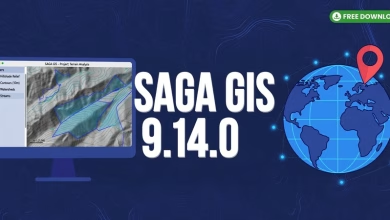
SAGA GIS (System for Automated Geoscientific Analyses) is a free tool focused on terrain and environmental modeling. Slope, aspect, hillshade, and watershed analysis take only a few clicks.
Download: saga-gis.org
Best for: DEM analysis, hydrology, and terrain modeling.
6. WhiteboxTools – Best for LiDAR and DEM Work
WhiteboxTools is a free geospatial analysis engine with 500+ tools for LiDAR, DEM, and hydrological analysis. It also works as a QGIS plugin, so you can use it without leaving QGIS.
Download: whiteboxgeo.com
Best for: LiDAR processing and advanced terrain analysis.
7. GeoServer – Best Free Web Mapping Server
GeoServer lets you publish your maps and spatial data on the web for free. Upload a shapefile, publish it as a web service (WMS/WFS), and view it in any browser. A must-learn skill for GIS jobs.
Download: geoserver.org/download
Best for: Web GIS, sharing maps online, and portfolio projects.
8. QField – Best Free Mobile GIS App
QField is the official mobile companion of QGIS. Prepare your project in QGIS on desktop, take it to the field on your phone, collect points and photos with GPS, and sync everything back. Completely free.
Download: qfield.org (Android, iOS, Windows)
Best for: Field data collection and survey work.
9. Mergin Maps – Easiest Field Data Sync
Mergin Maps makes field data collection simple for teams. Sync QGIS projects to your phone, collect data offline in the field, and merge everyone’s work automatically. Free plan available for students.
Download: merginmaps.com
Best for: Team field surveys and easy QGIS sync.
10. gvSIG – Simple Free Desktop GIS
gvSIG is a free desktop GIS with a clean interface, good for learning the basics of mapping, geoprocessing, and 3D views without feeling overwhelmed.
Download: gvsig.com
Best for: Beginners who want a simple desktop GIS.
Related: Download gvSIG 2.6 free GIS software
11. Orfeo ToolBox (OTB) – Best Free Remote Sensing Library
Orfeo ToolBox is a free open-source library for remote sensing image processing: segmentation, classification, and feature extraction. It plugs directly into QGIS.
Download: orfeo-toolbox.org
Best for: Remote sensing students and image classification.
12. uDig – Lightweight Free GIS Viewer
uDig is a small, fast, and simple free GIS application. It is not as powerful as QGIS, but it opens shapefiles and web map services quickly, which makes it great for quick viewing tasks.
Download: udig.refractions.net
Best for: Quick map viewing and learning GIS basics.
Comparison Table: All 12 Free GIS Software Tools
| Tool | Platform | Best For | Price |
|---|---|---|---|
| QGIS | Windows, Mac, Linux | Complete GIS projects | Free |
| Google Earth Pro | Windows, Mac | Easy visualization | Free |
| ESA SNAP | Windows, Mac, Linux | Satellite imagery | Free |
| GRASS GIS | Windows, Mac, Linux | Advanced analysis | Free |
| SAGA GIS | Windows, Linux | Terrain analysis | Free |
| WhiteboxTools | Windows, Mac, Linux | LiDAR and DEM | Free |
| GeoServer | Windows, Mac, Linux | Web mapping | Free |
| QField | Android, iOS | Field data collection | Free |
| Mergin Maps | Android, iOS | Team field surveys | Free plan |
| gvSIG | Windows, Mac, Linux | Simple desktop GIS | Free |
| Orfeo ToolBox | Windows, Mac, Linux | Remote sensing | Free |
| uDig | Windows, Mac, Linux | Quick map viewing | Free |
Which Free GIS Software Should You Choose?
- Complete beginner? Start with Google Earth Pro, then move to QGIS.
- University student? Learn QGIS deeply — it is the industry free standard.
- Satellite images and remote sensing? Use ESA SNAP + Orfeo ToolBox.
- Field survey work? Use QField or Mergin Maps with QGIS.
- Want a GIS job? Add GeoServer (web GIS) to your QGIS skills.
- Terrain, DEM, or LiDAR? Use SAGA GIS and WhiteboxTools.
FAQs – Free GIS Software
Which free GIS software is best for students?
QGIS is the best free GIS software for students. It is completely free, open-source, and used by professionals worldwide.
Is Google Earth Pro really free?
Yes. Google Earth Pro is 100% free for everyone, including commercial use.
Can I learn GIS without paying for software?
Yes. With QGIS, Google Earth Pro, SNAP, and the other tools in this list, you can learn complete GIS without spending anything.
QGIS vs ArcGIS – which should a student learn?
Learn QGIS first because it is free. The concepts transfer directly to ArcGIS, and many employers now accept QGIS skills.
Do I need a powerful computer for free GIS software?
No. QGIS and Google Earth Pro run fine on a normal student laptop with 8 GB RAM. Only heavy LiDAR work needs more power.
Where can I download free GIS software safely?
Always download from the official websites linked in this guide. Avoid random download sites.
In conclusion, you do not need paid software to become skilled in GIS. Start with QGIS and Google Earth Pro, add SNAP for satellite work or QField for field surveys, and build real projects for your portfolio. Bookmark this page — we keep this list updated every year.
Related posts: QGIS Download for Windows and Mac | Download gvSIG 2.6 | GRASS GIS Download | ENVI 5.3 Software
Disclosure: Some links on this page are affiliate links. If you buy a book through them, CartoGeek may earn a small commission at no extra cost to you. This helps keep our GIS guides free for students. Thank you for your support!
Recommended GIS Books
Learn QGIS: Techniques for Efficient Spatial Analysis (5th Edition)
by Eugenia Sarafova, Ivan Ivanov, Andrew Cutts, Anita Graser
The most current beginner-to-intermediate QGIS book, covering spatial analysis, cartography, field data collection and earth observation workflows with real-world examples. Written with input from Anita Graser, a well-known QGIS community figure, it walks readers from first install to confident analysis.
Pros:
- Up to date with recent QGIS versions
- Hands-on, exercise-driven teaching style
- Covers modern topics like GenAI tools and mobile data collection
Cons:
- Moves fast for absolute beginners with zero GIS background
- Some advanced chapters assume basic statistics knowledge

QGIS Quick Start Guide: A Beginner’s Guide to Getting Started with QGIS
by Andrew Cutts
A short, beginner-friendly entry point to QGIS that steps through loading data, creating vector layers, styling, labeling and building your first maps. Its narrative style builds confidence quickly for readers who want results in a weekend.
Pros:
- Short and approachable — no 800-page intimidation
- Clear step-by-step instructions
- Good first book before tackling heavier texts
Cons:
- Based on an older QGIS version, so some screenshots differ
- Light on advanced analysis topics
Making Maps: A Visual Guide to Map Design for GIS (4th Edition)
by John Krygier
A beautifully illustrated, playful guide to cartographic design — from map layout and color to typography and visual storytelling. The newest edition adds coverage of data aggregation, AI in mapping and modern map-making workflows.
Pros:
- The most enjoyable cartography book to read — visual and witty
- Teaches design thinking, not just button-clicking
- Companion website with map examples
Cons:
- Design-focused — not a GIS software manual
- Philosophical tone isn’t for everyone