This ESA SNAP download guide takes you from zero to your first processed satellite image. SNAP (Sentinel Application Platform) is the European Space Agency’s free software for working with Sentinel satellite data. Students use it to open Sentinel-2 images, make color composites, and calculate vegetation indices like NDVI. It costs nothing and runs on Windows, Mac, and Linux.
In this tutorial, you will install SNAP, download a free Sentinel-2 image from the Copernicus browser, open it in SNAP, create true-color and false-color images, calculate NDVI with band math, and export your result as a GeoTIFF. No prior remote sensing experience is needed.
ESA SNAP Download: Your First Sentinel-2 Project Step by Step
What Is ESA SNAP and Why Do Students Use It?
SNAP is ESA’s desktop application for processing Earth observation data. It was built for the Sentinel missions: Sentinel-1 radar, Sentinel-2 optical, and Sentinel-3 ocean and land data. It also opens Landsat, MODIS, and many other satellite formats.
Students choose SNAP for three simple reasons. First, it is completely free with no license limits, even for commercial use. Second, it is the official tool ESA itself maintains for Sentinel data, so tutorials and plugins always work with new imagery. Third, it handles the hard preprocessing steps (calibration, resampling, atmospheric correction) that general GIS software cannot do well.
System Requirements
| Component | Minimum | Recommended |
|---|---|---|
| Operating system | Windows 10/11 64-bit, macOS 12+, or 64-bit Linux | Same, fully updated |
| RAM | 4 GB | 8 GB or more |
| Disk space | 3 GB free for SNAP | 20 GB+ free (satellite images are large) |
| Internet | Needed for download | Fast connection (one image is ~1 GB) |
SNAP bundles its own Java runtime, so you do not need to install Java separately. A full Sentinel-2 tile is about 500 MB to 1 GB, which is why extra disk space matters.
Step 1: Download SNAP from ESA’s Official Page
Go to the official download page: step.esa.int – SNAP download. This is the only safe source. Never download SNAP from random software sites.
Accept the license terms and pick the installer for your system: Windows 64-bit, macOS, or Linux. The unified installer includes all toolboxes (Sentinel-1, Sentinel-2, Sentinel-3, and more). The download is roughly 700 MB to 1 GB depending on the version.
Step 2: Install SNAP on Windows, Mac, or Linux
Run the installer and follow the wizard. Accept the default installation folder unless you have a reason to change it. On Windows, let the installer create the Start menu shortcuts.
After installation, open SNAP and update its modules: go to Tools > Plugins > Updates and install everything offered. This keeps your Sentinel toolboxes current. Restart SNAP when asked.
Optional but useful: in Tools > Plugins > Available Plugins, install the Sen2Cor plugin. It converts Sentinel-2 L1C images to atmospherically corrected L2A images, which give more accurate NDVI values.
Step 3: Download a Free Sentinel-2 Image
Free Sentinel-2 imagery lives in the Copernicus Data Space Ecosystem browser: dataspace.copernicus.eu/browser. Create a free account and sign in.
Zoom the map to your study area and draw a small rectangle over it. In the search panel, select the Sentinel-2 mission and pick a recent date with low cloud cover (below 10%). Click a result tile and download the product.
You get a ZIP file containing a .SAFE folder. Unzip it completely before opening it in SNAP. Do not try to open the ZIP directly — SNAP needs the extracted folder.
Step 4: Open Your First Product in SNAP
In SNAP, go to File > Open Product. Navigate into the unzipped .SAFE folder and select the file named MTD_MSIL1C.xml. Click Open. SNAP reads the product metadata and lists its bands.
You can also drag the .SAFE folder straight into SNAP’s Product Explorer. Either way, the product appears with its bands grouped by resolution: 10 m, 20 m, and 60 m.
Step 5: Make True-Color and False-Color Images
Right-click the product in the Product Explorer and choose Open RGB Image Window. For a natural true-color view, assign Red = B4, Green = B3, Blue = B2. These are Sentinel-2’s 10 m visible bands. Your area now looks like a normal photograph from space.
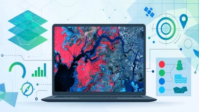
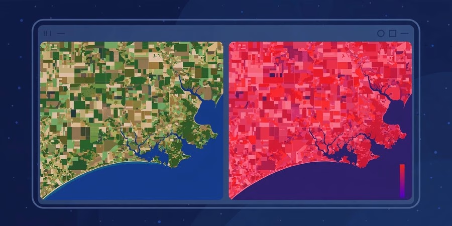
Now make a false-color image that highlights vegetation: Red = B8 (near-infrared), Green = B4, Blue = B3. Healthy vegetation reflects near-infrared strongly, so fields and forests glow bright red. Water and cities turn dark. This single view teaches you more about band combinations than any textbook paragraph.
Step 6: Calculate NDVI with Band Math (Real Analysis)
You have viewed images. Now measure something. Go to Raster > Band Maths. Create a new band named NDVI and type this expression:
(B8 – B4) / (B8 + B4)
Both B8 and B4 are 10 m bands, so no resampling is needed. Click OK. SNAP computes the Normalized Difference Vegetation Index for every pixel. Values near 1 mean dense healthy vegetation. Values near 0 mean bare soil or rock. Water gives negative values.
Double-click the NDVI band to view it. Try the color palette tools to stretch the contrast. You just performed real satellite image analysis in ESA SNAP, the same workflow researchers use.
Step 7: Export Your Result as GeoTIFF
A result you cannot share is not finished. Select your NDVI band, then go to File > Export > GeoTIFF. Choose a folder and save.
The exported GeoTIFF keeps the georeferencing, so you can open it in QGIS or any GIS software and overlay it on other maps. You now hold a real vegetation map made by you from free satellite data.
5 Mistakes Every SNAP Beginner Makes
1. Downloading SNAP from unofficial websites. Always use step.esa.int. Random download sites bundle outdated or infected installers.
2. Opening the ZIP instead of the unzipped folder. Extract the .SAFE folder fully first. SNAP cannot read products inside a ZIP.
3. Mixing band resolutions in band math. If you combine a 10 m band with a 20 m band, resample first with Raster > Geometric Operations > Resampling.
4. Processing a full tile on a weak laptop. Use Raster > Subset to cut a small area around your study site. Everything runs ten times faster.
5. Using L1C data for quantitative work. L1C is top-of-atmosphere reflectance. For serious NDVI comparisons across dates, use L2A products or run Sen2Cor.
⬇ Download ESA SNAP Free (Official Site)
ESA SNAP Download FAQs
Is ESA SNAP really free?
Yes. SNAP is free and open-source for everyone, including students, researchers, and commercial users. ESA maintains it under the STEP program.
What satellite data can SNAP open?
Sentinel-1, Sentinel-2, and Sentinel-3 are its main missions. It also reads Landsat, MODIS, SPOT, RapidEye, and many more through its toolboxes.
Where can I download free Sentinel-2 images?
From the Copernicus Data Space Ecosystem browser at dataspace.copernicus.eu. A free account gives you full access to the complete Sentinel-2 archive.
How much disk space does one Sentinel-2 image need?
A single L1C tile is about 500 MB to 1 GB as a ZIP, and the same again after unzipping. Keep at least 20 GB free when working with several images.
Can SNAP run on a low-spec laptop?
Yes, with 4 GB of RAM it opens and views products fine. For processing, 8 GB is much smoother. Always subset your image to a small study area first.
Should I learn SNAP or QGIS for satellite images?
Learn both. SNAP is purpose-built for preprocessing and analyzing Sentinel data. QGIS is better for mapping and combining results. Our QGIS download guide gets you started with the second half.
System requirements (SNAP latest): Windows 10/11 64-bit, macOS 12+, or 64-bit Linux | 4 GB RAM minimum (8 GB+ recommended) | 3 GB free disk for SNAP + 20 GB for data | internet for downloads. SNAP is free from step.esa.int.
Related posts: 12 Best Free GIS Software for Students (2026) · Introduction to Remote Sensing · QGIS Download for Windows, MacOS and Linux · GRASS GIS Software Download
You downloaded ESA SNAP, opened a real Sentinel-2 image, built true-color and false-color views, calculated NDVI, and exported a georeferenced map. That is the complete beginner workflow for satellite image processing. Practice it on your own study area this week, then try Sentinel-1 radar data or the Sen2Cor atmospheric correction. SNAP is free, official, and yours to master. Keep exploring the planet from space.