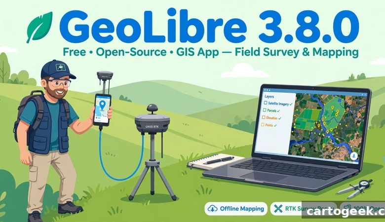
This GeoLibre 3.8.0 free download guide gets you the newest release of the free, open-source, cloud-native GIS that runs in your browser, on your desktop, and on your phone — with your data staying on your own machine. GeoLibre 3.8.0 shipped on November 14, 2026, and it is the release field teams have been waiting for: you can now import a complete QGIS or QField project — forms, symbology, and linked tables included — and collect data with a centimeter-grade Bluetooth GNSS rover fed by RTK corrections, all from the Android app. Below you will find what’s new, how to launch it with no install, desktop and mobile download steps, system requirements, and answers to the most common questions.
GeoLibre 3.8.0 Download: What’s New in This Release
Version 3.8.0 builds directly on v3.7.0 (indoor maps with IMDF venue archives and IndoorGML buildings, ArcGIS I3S Building Scene Layers, the JAXA Earth plugin with 119 datasets, ellipsoid-based measurement) and v3.6.1 (map CRS from a link or plugin, a more reliable OSM Downloader, live desktop control over MCP, plugin file handlers). The official release notes credit 58 pull requests from 10 contributors, 8 of them contributing for the first time. The changes below are the ones that matter to students, researchers, field surveyors, and working GIS analysts, grouped by what they actually do.
Complete QGIS and QField projects: forms, symbology, and linked tables
Importing a QGIS project now brings each layer’s full attribute form — Value Map, Range, Checkbox, Date/Time, and UUID widgets, Value Relation and Relation Reference dropdowns, aliases, required fields, defaults, sections, and photo fields — plus its categorized, graduated, and rule-based symbology. GeoPackage tables without geometry come in as table layers, and relation dropdowns read them live, so a project prepared for QField collects data the same way in GeoLibre. If you already run QGIS or QField in the field, your existing projects now open in GeoLibre without rebuilding a single form — see the new Projects guide in the official docs.
Bluetooth GNSS and RTK corrections on Android
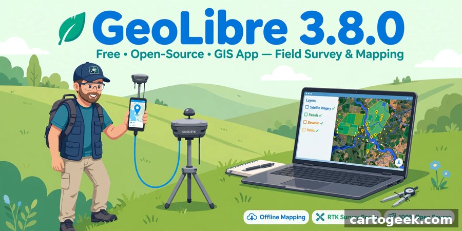
The Android app now connects to a paired Bluetooth GNSS receiver directly and feeds it RTK corrections from an NTRIP caster (NTRIP 1.0 and 2.0, optionally over TLS). The corrections go straight to the receiver, so a survey-grade rover needs no second app — open the app, pair the receiver, and survey at centimeter accuracy. This is the single biggest field-collection upgrade in GeoLibre’s history, and it turns an ordinary Android phone into a proper survey controller. See the GPS Tracking section of the official user guide for the RTK setup.
STAC search by shape, with a cloud-cover cap
The STAC browser now searches by a drawn point, line, or polygon, a selected feature, or a file, with an optional buffer around the shape. Results sort by date, a Max cloud filter keeps hazy scenes out, and items can be added with band renderings. If you hunt satellite imagery for a study area, you can now draw the exact area on the map and filter out cloudy scenes before you download anything — no more scrolling through unusable acquisitions.
Planetary Computer, fully connected
The Planetary Computer panel adds date-range mosaics, restyles layers after they are added, identifies pixel values, and turns search results into a Time Slider stack with a pixel time series. Python and the MCP server can author Planetary Computer layers, and AI Assistant layers now show up in the panel too. Microsoft’s Planetary Computer catalog — Landsat, Sentinel, and more — is now a first-class, time-aware data source inside GeoLibre instead of a manual download step.
Earthdata GIS: infinite scroll and raster functions
Earthdata GIS results now load as you scroll, and an image service’s card picks one of its published raster functions — such as NDVI — which you can switch on a layer already on the map. Browsing NASA’s Earthdata catalog is faster, and switching a layer between raw bands and a computed index like NDVI no longer means re-adding the service.
Model Builder samples: six ready-to-run workflows
A new Samples menu opens six ready-to-run workflows — from DEM stream networks and Strahler order to terrain derivatives, contours, and route stations near cities — each with its sample data included. If Model Builder felt like a blank canvas before, these samples show you a finished workflow you can run, inspect, and adapt. It is the fastest way to learn GeoLibre’s geoprocessing, and the quickest route to a real result.
AI Assistant and plugins: new providers and new APIs
TrustedRouter joins the AI providers, and a managed deployment can switch on keyless Parallel web search. Plugins can now read files shipped in their own bundle with app.readPluginAsset() and send headers such as Authorization for tiles they draw themselves with app.setUrlRequestHeaders(). Plugin authors get more power, and managed deployments get web search without juggling API keys — see the AI Assistant guide and the Plugin API docs.
Fixes: quick filters, 3D projects, Zarr, ArcGIS ImageServer, and 110+ Whitebox tools
Quick filters now count values across the whole layer instead of only the first 5,000 features; saved projects reopen in 3D with their terrain look intact; Zarr layers redraw on reopen; ArcGIS ImageServer source rasters draw and identify pixel values; story map chapter fades keep layer styles; and more than 110 Whitebox tools now reach Model Builder thanks to typed generic WASM outputs. None of these is a headline alone, but together they remove a set of small, recurring frustrations — especially the Model Builder expansion for geoprocessing users.
How to launch GeoLibre 3.8.0 (no install)
Open https://web.geolibre.app in Chrome, Edge, Firefox, or Safari. That’s it — the full GIS loads in the tab. Try the gallery first: pick any of the open-data maps (NASA fire detections, USGS earthquakes) to see layers, legends, and popups working. Add your own data with the Add Data button: drag a GeoTIFF, Shapefile, GeoJSON, or CSV onto the map, or paste a web address for a cloud-optimized GeoTIFF, GeoParquet, FlatGeobuf, or a STAC point-cloud asset — cloud files stream by range, so even huge files open fast. To try the new QGIS project import, open a .qgz or .qgs project you already use in QGIS; to try the Model Builder samples, open the Samples menu. Save your work as a project file and reopen it later from the same menu.
Launch GeoLibre Free in Your Browser
How to download GeoLibre 3.8.0 desktop and mobile
Prefer a native app? The desktop edition (built on Tauri) is on the official GitHub releases page for the opengeos/GeoLibre repository, tag v3.8.0. Grab the installer for your system: Windows (.exe setup or .msi, plus a portable zip and .msix), macOS (signed .dmg for Apple Silicon and Intel), or Linux (.deb, .rpm, or AppImage). Android ships four APKs (arm, arm64, x86, x86_64) plus an .aab, and an iOS App Store .ipa is attached too, plus a Chrome extension zip. Run the installer, accept the defaults, and launch GeoLibre from your applications menu. The desktop app signs in to the same cloud services as the web app, so projects move between the two. Always download from the official GeoLibre site or the official GitHub releases — never from random mirror sites.
System requirements
| Requirement | Detail |
|---|---|
| Web app | Any modern browser (Chrome, Edge, Firefox, Safari); no installation, internet for first load |
| Desktop (Windows) | Windows 10/11 64-bit; .exe setup, .msi, portable zip, or .msix from GitHub releases |
| Desktop (macOS) | Signed .dmg; Apple Silicon and Intel supported |
| Desktop (Linux) | .deb, .rpm, or AppImage |
| Mobile | Android APKs (arm, arm64, x86, x86_64) + .aab attached to the release; iOS App Store .ipa attached; Bluetooth GNSS + NTRIP RTK on Android |
| Memory (RAM) | 4 GB minimum, 8 GB recommended for large raster/vector projects |
| Jupyter use | Python 3.12 for the desktop sidecar/Jupyter environments (pinned since 3.6.1); see official docs |
The web app needs nothing installed at all — if your browser can run Google Maps, it can run GeoLibre. For heavy local analysis, the desktop build keeps everything on your machine.
Frequently asked questions
Is GeoLibre 3.8.0 really free?
Yes. GeoLibre is free and open-source software maintained on GitHub by the opengeos organization. There is no paid edition and no feature paywall.
Do I need to install anything to use GeoLibre?
No. The web app at web.geolibre.app runs entirely in your browser. Install the desktop edition only if you want a native app or offline-heavy workflows, or the mobile app for field use.
What’s new in GeoLibre 3.8.0?
Complete QGIS and QField project import (attribute forms with Value Map, Range, Checkbox, Date/Time, and UUID widgets, Value Relation dropdowns, photo fields, and categorized/graduated/rule-based symbology, plus GeoPackage tables as table layers); Bluetooth GNSS with NTRIP RTK corrections on Android (NTRIP 1.0 and 2.0, optionally over TLS); STAC search by drawn shape, selected feature, or file with buffer, date sorting, a Max cloud filter, and band renderings; Planetary Computer date-range mosaics, restyling, Identify, Time Slider stacks with pixel time series, and Python/MCP authoring; Earthdata GIS infinite scroll and switchable raster functions like NDVI; six ready-to-run Model Builder samples; TrustedRouter as an AI provider plus keyless Parallel web search and new plugin APIs; and fixes for quick filters, 3D project reopening, Zarr layers, ArcGIS ImageServer, story maps, and 110+ Whitebox tools reaching Model Builder.
Should I upgrade from GeoLibre 3.7.0?
Yes — 3.8.0 is a minor release with no breaking changes and it includes everything in 3.7.0 and 3.6.1. If you use QGIS or QField projects, collect data in the field, or search satellite imagery, upgrade now; everyone else gets the Planetary Computer, Earthdata, Model Builder, and fix improvements. Note: if you have not installed 3.7.0 yet, go straight to 3.8.0 — it includes everything in 3.7.0 and 3.6.x.
Can GeoLibre really replace QField for field data collection?
For many workflows, yes — 3.8.0 imports your QField-ready project with its forms and symbology intact, and the Android app now talks to a Bluetooth GNSS rover with RTK corrections for centimeter accuracy. QField remains the dedicated field app, but GeoLibre is now a genuine alternative that runs the same project.
Does GeoLibre replace QGIS?
Not exactly. QGIS remains the deepest desktop GIS. GeoLibre is the fastest way to do serious GIS in a browser tab, on a phone, or in a notebook — many users run both, with GeoLibre for quick sharing and cloud data.
Does my data leave my computer?
No. GeoLibre is local-first: your layers and projects stay on your machine (or in the storage you explicitly connect, like your own S3 bucket). The “cloud-native” label refers to streaming cloud data formats, not uploading yours.
Who makes GeoLibre?
Qiusheng Wu (@giswqs) and contributors under the opengeos GitHub organization. Development is public, and releases land on GitHub roughly weekly — v3.8.0’s changelog (58 pull requests, 10 contributors, 8 first-time) also restructures the NGIS 2026 workshop into eight new sections and translates 135 new strings in all 20 locales.
GeoLibre 3.8.0 is the release that closes the gap with QGIS and QField — your existing projects open complete, with forms and symbology intact — while adding centimeter-grade RTK surveying on Android and much richer satellite search through STAC and Planetary Computer. Launch it now, and open one of your own QGIS projects to see the import in action.
Related posts: GeoLibre 3.7.0 Free Download · GeoLibre Free Download (v3.4.0) · QGIS 4.2 Free Download · WhiteboxTools Free Download
Disclosure: Some links on this page are affiliate links. If you buy a book through them, CartoGeek may earn a small commission at no extra cost to you. This helps keep our GIS guides free for students. Thank you for your support!
Recommended GIS Books
Learn QGIS: Techniques for Efficient Spatial Analysis (5th Edition)
by Eugenia Sarafova, Ivan Ivanov, Andrew Cutts, Anita Graser
The most current beginner-to-intermediate QGIS book, covering spatial analysis, cartography, field data collection and earth observation workflows with real-world examples. Written with input from Anita Graser, a well-known QGIS community figure, it walks readers from first install to confident analysis.
Pros:
- Up to date with recent QGIS versions
- Hands-on, exercise-driven teaching style
- Covers modern topics like GenAI tools and mobile data collection
Cons:
- Moves fast for absolute beginners with zero GIS background
- Some advanced chapters assume basic statistics knowledge

QGIS Quick Start Guide: A Beginner’s Guide to Getting Started with QGIS
by Andrew Cutts
A short, beginner-friendly entry point to QGIS that steps through loading data, creating vector layers, styling, labeling and building your first maps. Its narrative style builds confidence quickly for readers who want results in a weekend.
Pros:
- Short and approachable — no 800-page intimidation
- Clear step-by-step instructions
- Good first book before tackling heavier texts
Cons:
- Based on an older QGIS version, so some screenshots differ
- Light on advanced analysis topics
Learning Geospatial Analysis with Python (3rd Edition)
by Joel Lawhead
A systematic guide to GIS and remote sensing analysis with Python, covering geodatabases, raster data, PostGIS, QGIS integration and workflow automation. Readers build real analytical skills, from thematic mapping to flood modeling.
Pros:
- Bridges GIS and Python — the highest-demand skill combo
- Practical projects, not just theory
- Covers the open-source stack (GeoPandas-style workflows, PostGIS, QGIS)
Cons:
- Requires basic Python knowledge first
- Some library versions have moved on since publication