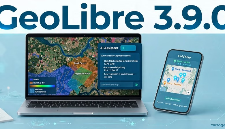
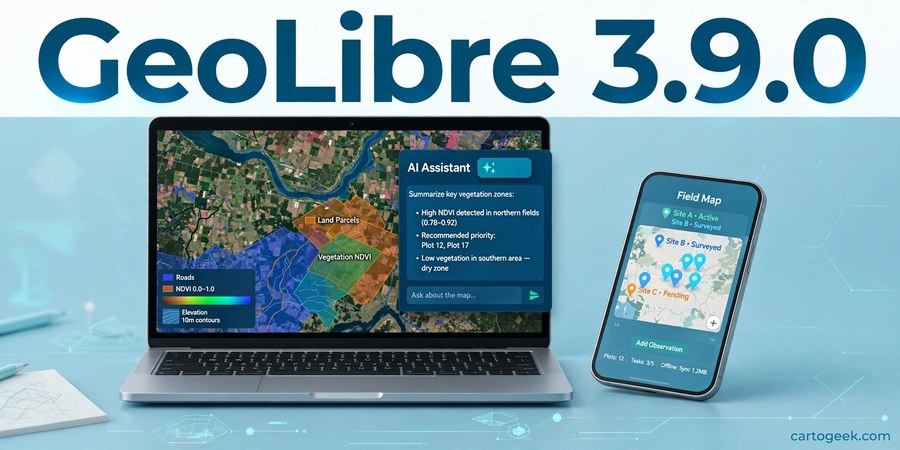
This GeoLibre 3.9.0 free download guide gets you the newest release of the free, open-source, cloud-native GIS that runs in your browser, on your desktop, and on your phone — with your data staying on your own machine. GeoLibre 3.9.0 shipped on November 17, 2026, just three days after 3.8.0, and it makes the built-in AI Assistant much easier to use: you can now sign in with your ChatGPT plan instead of pasting an API key, and the assistant keeps your conversation when you switch providers or models. It also adds Gallery collections of shared projects, a Summarize within tool that counts and totals features inside polygons, and Traditional Chinese for Taiwan, Hong Kong, and Macau. Below you will find what’s new, how to launch it with no install, desktop and mobile download steps, system requirements, and answers to the most common questions.
GeoLibre 3.9.0 Download: What’s New in This Release
Version 3.9.0 builds directly on v3.8.0 (complete QGIS and QField project import, Bluetooth GNSS with NTRIP RTK on Android, STAC search by shape, Planetary Computer date-range mosaics, Earthdata GIS raster functions, six ready-to-run Model Builder samples) and v3.7.0 (indoor maps with IMDF venue archives and IndoorGML buildings, ArcGIS I3S Building Scene Layers, the JAXA Earth plugin with 119 datasets). The official release notes credit 35 pull requests from 2 contributors. The changes below are the ones that matter to students, researchers, field surveyors, and working GIS analysts, grouped by what they actually do.
Sign in with ChatGPT: the AI Assistant runs on your plan
The desktop AI Assistant can now use your ChatGPT plan instead of an API key. Sign-in runs in your system browser and the tokens stay in the system keychain, so nothing sensitive is pasted into a settings box. Settings shows the signed-in account, a link to usage, and sign-out. If you already pay for ChatGPT, the assistant inside GeoLibre now costs nothing extra — ask it to style a layer, explain a tool, or build a workflow without setting up a separate API account first. See the AI Assistant guide in the official docs.
An AI Assistant that keeps the thread
Switching profiles or models mid-conversation now carries the conversation over to the new provider instead of starting empty, so you can move a half-finished task from one model to another without re-explaining it. A new set_view tool moves the camera to an exact center, zoom, rotation, and tilt on command, and the panel marks the default profile so you always know which model is answering. The assistant is now a real pair of hands on the map, not a chat box that forgets what you were doing.
Gallery collections: curated projects, one click away
Open from Gallery has a new Collections tab that browses public collections from share.geolibre.app and opens their projects in place. Instead of starting from a blank map, pick a curated collection — a teaching set, a hazard map, a city dataset — and the whole project loads ready to explore. It is the fastest way to learn what GeoLibre can do, and the easiest way to share a finished map with a class or a client.
Summarize within: count and total features inside polygons
A new client-side Vector tool counts the features of another layer inside each polygon, summarizes a numeric field (sum, mean, min, max), and measures how much of each polygon other polygons cover, without double-counting overlaps. How many buildings fall in each ward, what is the total population in each district, how much of a forest parcel is inside a protected area — the answers now come from one tool instead of a chain of clips, joins, and spreadsheet math. See the Processing guide in the official docs.
Number columns that read like QGIS
The attribute table right-aligns number columns and rounds floating-point noise for display only, so sorting, editing, and export keep the raw value, and missing values show as NULL. It is a small change that makes long tables far easier to scan — the same readability QGIS users expect, now in the browser and on the desktop.
Terrain and QGIS projects: filled DEMs and richer imports
A custom COG DEM can now be surrounded, and its no-data gaps filled, by the global terrain instead of a flat plain, so a local elevation model blends into the world around it. QGIS project import now brings in WMS and XYZ layers, remote GeoParquet, and the project’s default view, on top of the complete forms and symbology that arrived in 3.8.0. Your existing QGIS projects open even more faithfully — see the Projects guide in the official docs.
Traditional Chinese: 23 translations beyond English
The interface now ships in Traditional Chinese for Taiwan, Hong Kong, and Macau, bringing it to 23 translations beyond English. If you teach or work in Traditional Chinese, GeoLibre now speaks your language across the whole interface, including the new Gallery collections and Summarize within strings.
Fixes: plugins, QML import, Planetary Computer, Cesium, and more
Plugin asset URLs are now encoded the same way as plugin file reads; QML imports convert classified symbol sizes and widths by their QGIS unit; the Planetary Computer Time Slider stays bound to its own scenes; Quick filters stay inside the panel for long field names; PostGIS and YOLO downloads, the tool list, and unique output names are faster and safer; Cesium gets CRS84 GeoJSON, COPC ground height, and pole-wrapping polygons; collaboration locks and view-only sync, photo popups, and story map exports are fixed; buffers, zoom-to-layer, and fits now handle the antimeridian; and the layout keeps its panels on screen in short windows and on narrow phones. None of these is a headline alone, but together they remove a set of small, recurring frustrations.
How to launch GeoLibre 3.9.0 (no install)
Open https://web.geolibre.app in Chrome, Edge, Firefox, or Safari. That’s it — the full GIS loads in the tab. Try the gallery first: open the Collections tab and load a curated project to see layers, legends, and popups working. Add your own data with the Add Data button: drag a GeoTIFF, Shapefile, GeoJSON, or CSV onto the map, or paste a web address for a cloud-optimized GeoTIFF, GeoParquet, FlatGeobuf, or a STAC point-cloud asset — cloud files stream by range, so even huge files open fast. To try the new Summarize within tool, load a polygon layer and a point layer, then open Processing > Vector > Summarize within. Save your work as a project file and reopen it later from the same menu.
Launch GeoLibre Free in Your Browser
How to download GeoLibre 3.9.0 desktop and mobile
Prefer a native app? The desktop edition (built on Tauri) is on the official GitHub releases page for the opengeos/GeoLibre repository, tag v3.9.0. Grab the installer for your system: Windows (.exe setup or .msi, plus a portable zip and .msix), macOS (signed .dmg for Apple Silicon and Intel), or Linux (.deb, .rpm, or AppImage). Android ships four APKs (arm, arm64, x86, x86_64) plus an .aab, and an iOS App Store .ipa is attached too, plus a Chrome extension zip. Run the installer, accept the defaults, and launch GeoLibre from your applications menu. The desktop app is the one that offers ChatGPT sign-in for the AI Assistant. Always download from the official GeoLibre site or the official GitHub releases — never from random mirror sites.
System requirements
| Requirement | Detail |
|---|---|
| Web app | Any modern browser (Chrome, Edge, Firefox, Safari); no installation, internet for first load |
| Desktop (Windows) | Windows 10/11 64-bit; .exe setup, .msi, portable zip, or .msix from GitHub releases |
| Desktop (macOS) | Signed .dmg; Apple Silicon and Intel supported |
| Desktop (Linux) | .deb, .rpm, or AppImage |
| Mobile | Android APKs (arm, arm64, x86, x86_64) + .aab attached to the release; iOS App Store .ipa attached; Bluetooth GNSS + NTRIP RTK on Android |
| Memory (RAM) | 4 GB minimum, 8 GB recommended for large raster/vector projects |
| Jupyter use | Python 3.12 for the desktop sidecar/Jupyter environments (pinned since 3.6.1); see official docs |
The web app needs nothing installed at all — if your browser can run Google Maps, it can run GeoLibre. For heavy local analysis, the desktop build keeps everything on your machine.
Frequently asked questions
Is GeoLibre 3.9.0 really free?
Yes. GeoLibre is free and open-source software maintained on GitHub by the opengeos organization. There is no paid edition and no feature paywall. The ChatGPT sign-in uses your own ChatGPT plan — GeoLibre itself charges nothing.
Do I need to install anything to use GeoLibre?
No. The web app at web.geolibre.app runs entirely in your browser. Install the desktop edition only if you want a native app, offline-heavy workflows, or the ChatGPT sign-in for the AI Assistant, or the mobile app for field use.
What’s new in GeoLibre 3.9.0?
Sign in with ChatGPT for the desktop AI Assistant (no API key — sign-in in your system browser, tokens in the system keychain); the assistant keeps the conversation when you switch providers or models, with a new set_view tool and a marked default profile; Gallery collections from share.geolibre.app; a Summarize within vector tool that counts features, summarizes numeric fields (sum, mean, min, max), and measures polygon coverage without double-counting overlaps; right-aligned number columns with NULL for missing values in the attribute table; custom COG DEMs filled by global terrain and QGIS project imports with WMS/XYZ layers, remote GeoParquet, and the default view; Traditional Chinese for Taiwan, Hong Kong, and Macau (23 translations beyond English); and fixes for plugins, QML import, Planetary Computer, Cesium, PostGIS/YOLO downloads, collaboration, and layouts.
Should I upgrade from GeoLibre 3.8.0?
Yes — 3.9.0 is a minor release with no breaking changes and it includes everything in 3.8.0 and 3.7.0. If you use the AI Assistant, teach with shared projects, or summarize features inside polygons, upgrade now; everyone else gets the terrain, QGIS import, and fix improvements. Note: if you have not installed 3.8.0 yet, go straight to 3.9.0 — it includes everything in 3.8.0 and 3.7.0.
How does ChatGPT sign-in work — is my API key safe?
There is no API key to paste. You sign in with your ChatGPT plan in your system browser, and the tokens are stored in the system keychain. Settings shows the signed-in account, a link to usage, and sign-out, so you can revoke access any time.
Does GeoLibre replace QGIS?
Not exactly. QGIS remains the deepest desktop GIS. GeoLibre is the fastest way to do serious GIS in a browser tab, on a phone, or in a notebook — many users run both, with GeoLibre for quick sharing and cloud data. Version 3.9.0 narrows the gap further: QGIS projects now import with WMS/XYZ layers, remote GeoParquet, and the default view.
Does my data leave my computer?
No. GeoLibre is local-first: your layers and projects stay on your machine (or in the storage you explicitly connect, like your own S3 bucket). The “cloud-native” label refers to streaming cloud data formats, not uploading yours.
Who makes GeoLibre?
Qiusheng Wu (@giswqs) and contributors under the opengeos GitHub organization. Development is public, and releases land on GitHub roughly weekly — v3.9.0’s changelog (35 pull requests, 2 contributors) also fills 32 missing strings in every locale and bumps i18next to 27.
GeoLibre 3.9.0 makes the AI Assistant a real part of the app — sign in with the ChatGPT plan you already have, keep the conversation when you switch models, and let it move the camera for you — while Gallery collections and the Summarize within tool make sharing projects and answering “how much is inside this area” questions one click instead of a workflow. Launch it now, and open a collection from the Gallery to see it in action.
Related posts: GeoLibre 3.8.0 Free Download · GeoLibre 3.7.0 Free Download · QGIS 4.2 Free Download · WhiteboxTools Free Download
Disclosure: Some links on this page are affiliate links. If you buy a book through them, CartoGeek may earn a small commission at no extra cost to you. This helps keep our GIS guides free for students. Thank you for your support!
Recommended GIS Books
Learn QGIS: Techniques for Efficient Spatial Analysis (5th Edition)
by Eugenia Sarafova, Ivan Ivanov, Andrew Cutts, Anita Graser
The most current beginner-to-intermediate QGIS book, covering spatial analysis, cartography, field data collection and earth observation workflows with real-world examples. Written with input from Anita Graser, a well-known QGIS community figure, it walks readers from first install to confident analysis.
Pros:
- Up to date with recent QGIS versions
- Hands-on, exercise-driven teaching style
- Covers modern topics like GenAI tools and mobile data collection
Cons:
- Moves fast for absolute beginners with zero GIS background
- Some advanced chapters assume basic statistics knowledge

QGIS Quick Start Guide: A Beginner’s Guide to Getting Started with QGIS
by Andrew Cutts
A short, beginner-friendly entry point to QGIS that steps through loading data, creating vector layers, styling, labeling and building your first maps. Its narrative style builds confidence quickly for readers who want results in a weekend.
Pros:
- Short and approachable — no 800-page intimidation
- Clear step-by-step instructions
- Good first book before tackling heavier texts
Cons:
- Based on an older QGIS version, so some screenshots differ
- Light on advanced analysis topics
Learning Geospatial Analysis with Python (3rd Edition)
by Joel Lawhead
A systematic guide to GIS and remote sensing analysis with Python, covering geodatabases, raster data, PostGIS, QGIS integration and workflow automation. Readers build real analytical skills, from thematic mapping to flood modeling.
Pros:
- Bridges GIS and Python — the highest-demand skill combo
- Practical projects, not just theory
- Covers the open-source stack (GeoPandas-style workflows, PostGIS, QGIS)
Cons:
- Requires basic Python knowledge first
- Some library versions have moved on since publication