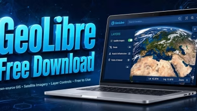
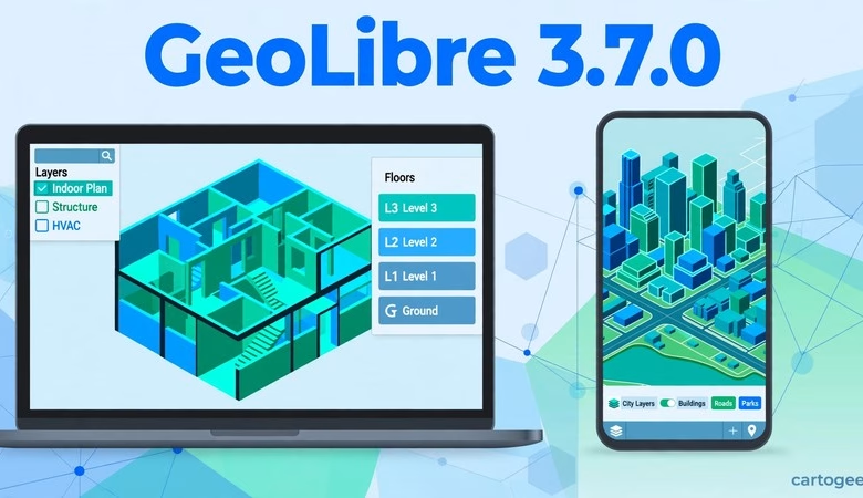
This GeoLibre 3.7.0 free download guide gets you the newest release of the free, open-source, cloud-native GIS that runs in your browser, on your desktop, and on your phone — with your data staying on your own machine. GeoLibre 3.7.0 shipped on November 7, 2026, and it is the biggest feature release in weeks: you can now open indoor maps (Apple IMDF venue archives and OGC IndoorGML buildings) and walk their floors with an on-map floor picker, draw ArcGIS I3S Building Scene Layers (BIM) again, and browse 119 JAXA Earth satellite datasets from inside the app. Below you will find what’s new, how to launch it with no install, desktop and mobile download steps, system requirements, and answers to the most common questions.
GeoLibre 3.7.0 Download: What’s New in This Release
Version 3.7.0 builds directly on v3.6.1 (map CRS from a link or plugin, a more reliable OSM Downloader, live desktop control over MCP, plugin file handlers) and v3.6.0 (India GIS catalog, plugin point clouds and private-S3 reads, async Python commands, the Explore_GeoLibre.ipynb notebook, editable database layers up to 1,000,000 features). The official release notes credit 48 pull requests from 6 contributors. The changes below are the ones that matter to students, researchers, and working GIS analysts, grouped by what they actually do.
Indoor maps: IMDF venues and IndoorGML buildings with a floor picker
You can now open an IMDF venue archive — the zip of GeoJSON that Apple Maps and many indoor-mapping tools export — as a ready-made 3D venue, or an OGC IndoorGML building from Add Data → IndoorGML Layer as extruded cells with its navigation network. An on-map Floor picker shows one floor, a cutaway of the floors below, or all of them at once, and clicking a room in the overview takes you straight to its floor. Two samples ship with the release to try it on: the Dinoseum and Berlin Hauptbahnhof. If you map campuses, malls, airports, or stations, this turns GeoLibre into a genuine indoor-mapping tool instead of a flat-floor workaround — see the new Indoor Maps and BIM guide in the official docs.
Stacked floors from data — one layer per building
The extrusion base can now come from a field, a scale, or an expression, and a floor height stacks every floor of a building from its level attribute in a single layer. Before this, multi-floor buildings needed one layer per floor; now a single indoor layer with a level field renders the whole stack. Combined with the floor picker above, a properly attributed building dataset is all you need for a working multi-floor map.
ArcGIS I3S scene layers and Building Scene Layers (BIM) work again
ArcGIS I3S scene layers draw again on deck.gl, and Building Scene Layers (BIM) load with discipline and category toggles, so you can isolate structural, architectural, or MEP elements of a building model. Hosted tiled imagery layers that cache raw LERC tiles — which used to come up empty — now draw through the ArcGIS SDK. If you work with ArcGIS scene services or BIM data, this release repairs two integrations that had gone quiet.
JAXA Earth: 119 satellite datasets inside GeoLibre
A new plugin under Plugins → Web Services browses all 119 JAXA Earth API datasets — from AW3D30 elevation to GSMaP precipitation and land surface temperature — and adds a band at a chosen date as a color-mapped layer you can step through in time. That puts free Japanese Earth-observation data (elevation, rainfall, temperature) one menu away from your map, with no separate download step. For remote-sensing teaching and quick environmental checks, it is the fastest new data source in this release.
Cartography and measurement: line styles, print layouts, ellipsoid math
Lines gain their own opacity, dashes, and blur in the layer style, also applied from imported Mapbox styles, so styled line layers finally survive a style import. The print layout gets a page background for dark maps and a footer that fits, and the field calculator, story maps, and processing tools now measure distances and areas on the ellipsoid instead of a sphere — so long-distance and large-area measurements are measurably more accurate. Small changes individually, but they fix the kind of cartographic niggles that show up in finished maps.
Deployment controls for administrators
Administrators can now turn off the Regional basemaps served from mainland China (an opened project that selects one now asks first), point the OSM Downloader at their own Overpass endpoint, save projects straight to the project server, open a plugin panel on startup, and give plugins a file-read allowlist. If you deploy GeoLibre for a classroom, lab, or organization, these switches let you lock the deployment down to your own infrastructure instead of the public defaults.
More for plugins: URL data reaches file handlers
Data opened with ?data= or the embed addData command is now offered to plugin file handlers, which can claim zips without an extension or declare their own dataType. If you embed GeoLibre maps that load data from a URL, plugins can now handle that data instead of it falling through to the generic loader.
Fixes: COGs, Polygonize, STAC dates, Ollama, Android picker
COGs draw correctly after opening a project with another basemap; Polygonize output draws containers before their islands; STAC searches send RFC 3339 date-times; an Ollama profile runs any typed model; spatial statistics find polygon neighbors from the area centroid; and the Android file picker keeps unmapped extensions selectable. None of these is a headline, but together they remove a set of small, recurring frustrations — especially the COG and STAC fixes for cloud-data workflows.
How to launch GeoLibre 3.7.0 (no install)
Open https://web.geolibre.app in Chrome, Edge, Firefox, or Safari. That’s it — the full GIS loads in the tab. Try the gallery first: pick any of the open-data maps (NASA fire detections, USGS earthquakes) to see layers, legends, and popups working. Add your own data with the Add Data button: drag a GeoTIFF, Shapefile, GeoJSON, or CSV onto the map, or paste a web address for a cloud-optimized GeoTIFF, GeoParquet, FlatGeobuf, or a STAC point-cloud asset — cloud files stream by range, so even huge files open fast. To try the new indoor maps, open the Dinoseum or Berlin Hauptbahnhof sample; to try JAXA Earth data, open Plugins → Web Services and pick a dataset and date. Save your work as a project file and reopen it later from the same menu.
Launch GeoLibre Free in Your Browser
How to download GeoLibre 3.7.0 desktop and mobile
Prefer a native app? The desktop edition (built on Tauri) is on the official GitHub releases page for the opengeos/GeoLibre repository, tag v3.7.0. Grab the installer for your system: Windows (.exe setup or .msi, plus a portable zip and .msix), macOS (signed .dmg for Apple Silicon and Intel), or Linux (.deb, .rpm, or AppImage). Android is back in this release: four APKs (arm, arm64, x86, x86_64) plus an .aab are attached — v3.6.1 had shipped iOS-only. An iOS App Store .ipa is attached too, and there is a Chrome extension zip. Run the installer, accept the defaults, and launch GeoLibre from your applications menu. The desktop app signs in to the same cloud services as the web app, so projects move between the two. Always download from the official GeoLibre site or the official GitHub releases — never from random mirror sites.
System requirements
| Requirement | Detail |
|---|---|
| Web app | Any modern browser (Chrome, Edge, Firefox, Safari); no installation, internet for first load |
| Desktop (Windows) | Windows 10/11 64-bit; .exe setup, .msi, portable zip, or .msix from GitHub releases |
| Desktop (macOS) | Signed .dmg; Apple Silicon and Intel supported |
| Desktop (Linux) | .deb, .rpm, or AppImage |
| Mobile | Android APKs (arm, arm64, x86, x86_64) + .aab attached to the release; iOS App Store .ipa attached |
| Memory (RAM) | 4 GB minimum, 8 GB recommended for large raster/vector projects |
| Jupyter use | Python 3.12 for the desktop sidecar/Jupyter environments (pinned since 3.6.1); see official docs |
The web app needs nothing installed at all — if your browser can run Google Maps, it can run GeoLibre. For heavy local analysis, the desktop build keeps everything on your machine.
Frequently asked questions
Is GeoLibre 3.7.0 really free?
Yes. GeoLibre is free and open-source software maintained on GitHub by the opengeos organization. There is no paid edition and no feature paywall.
Do I need to install anything to use GeoLibre?
No. The web app at web.geolibre.app runs entirely in your browser. Install the desktop edition only if you want a native app or offline-heavy workflows, or the mobile app for field use.
What’s new in GeoLibre 3.7.0?
Indoor maps (IMDF venue archives and OGC IndoorGML buildings with an on-map floor picker, room-click navigation, and Dinoseum + Berlin Hauptbahnhof samples); stacked floors from a level attribute in a single layer; ArcGIS I3S scene layers drawing again plus Building Scene Layers (BIM) with discipline/category toggles and fixed LERC-tiled imagery; a JAXA Earth plugin with 119 datasets (AW3D30 elevation, GSMaP precipitation, land surface temperature) as time-steppable color-mapped layers; line opacity, dashes, and blur in layer styles, print-layout page backgrounds, and ellipsoid-based measurement; admin deployment controls (regional-basemap switch, custom Overpass endpoint, remote project storage, plugin file-read allowlist); URL-loaded data reaching plugin file handlers; and fixes for COGs, Polygonize, STAC date-times, Ollama models, and the Android file picker.
Should I upgrade from GeoLibre 3.6.1?
Yes — 3.7.0 is a minor release with no breaking changes and it includes everything in 3.6.1 and 3.6.0. If you map buildings or campuses, use ArcGIS scene services, or want JAXA satellite data, upgrade now; everyone else gets the cartography, measurement, and deployment improvements. Note: if you have not installed 3.6.1 yet, go straight to 3.7.0 — it includes everything in 3.6.1 and 3.5.x.
Does GeoLibre replace QGIS?
Not exactly. QGIS remains the deepest desktop GIS. GeoLibre is the fastest way to do serious GIS in a browser tab, on a phone, or in a notebook — many users run both, with GeoLibre for quick sharing and cloud data.
Does my data leave my computer?
No. GeoLibre is local-first: your layers and projects stay on your machine (or in the storage you explicitly connect, like your own S3 bucket). The “cloud-native” label refers to streaming cloud data formats, not uploading yours.
Who makes GeoLibre?
Qiusheng Wu (@giswqs) and contributors under the opengeos GitHub organization. Development is public, and releases land on GitHub roughly weekly — v3.7.0’s changelog (48 pull requests, 6 contributors) also adds an Indoor Maps and BIM guide, a generated Python API reference, and a JOSS paper to the docs.
GeoLibre 3.7.0 is the release that takes GeoLibre indoors — IMDF and IndoorGML buildings, floor-by-floor navigation, and BIM layers — while adding a full JAXA Earth data catalog and the admin controls a classroom or lab deployment needs. Launch it now, and try the Berlin Hauptbahnhof sample to see the floor picker in action.
Related posts: GeoLibre Free Download (v3.4.0) · QGIS 4.2 Free Download · WhiteboxTools Free Download
Disclosure: Some links on this page are affiliate links. If you buy a book through them, CartoGeek may earn a small commission at no extra cost to you. This helps keep our GIS guides free for students. Thank you for your support!
Recommended GIS Books
Learn QGIS: Techniques for Efficient Spatial Analysis (5th Edition)
by Eugenia Sarafova, Ivan Ivanov, Andrew Cutts, Anita Graser
The most current beginner-to-intermediate QGIS book, covering spatial analysis, cartography, field data collection and earth observation workflows with real-world examples. Written with input from Anita Graser, a well-known QGIS community figure, it walks readers from first install to confident analysis.
Pros:
- Up to date with recent QGIS versions
- Hands-on, exercise-driven teaching style
- Covers modern topics like GenAI tools and mobile data collection
Cons:
- Moves fast for absolute beginners with zero GIS background
- Some advanced chapters assume basic statistics knowledge

QGIS Quick Start Guide: A Beginner’s Guide to Getting Started with QGIS
by Andrew Cutts
A short, beginner-friendly entry point to QGIS that steps through loading data, creating vector layers, styling, labeling and building your first maps. Its narrative style builds confidence quickly for readers who want results in a weekend.
Pros:
- Short and approachable — no 800-page intimidation
- Clear step-by-step instructions
- Good first book before tackling heavier texts
Cons:
- Based on an older QGIS version, so some screenshots differ
- Light on advanced analysis topics
Learning Geospatial Analysis with Python (3rd Edition)
by Joel Lawhead
A systematic guide to GIS and remote sensing analysis with Python, covering geodatabases, raster data, PostGIS, QGIS integration and workflow automation. Readers build real analytical skills, from thematic mapping to flood modeling.
Pros:
- Bridges GIS and Python — the highest-demand skill combo
- Practical projects, not just theory
- Covers the open-source stack (GeoPandas-style workflows, PostGIS, QGIS)
Cons:
- Requires basic Python knowledge first
- Some library versions have moved on since publication