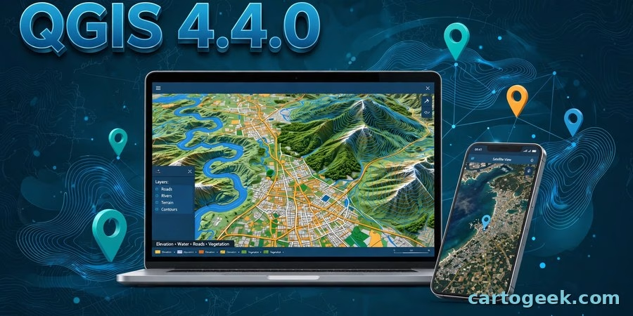
This QGIS 4.4.0 free download guide gets you the newest release of the world’s most popular free, open-source desktop GIS — and it is the one QGIS users have been waiting on since October. QGIS 4.4.0 shipped on November 20, 2026, three weeks after its planned October 30 date, delayed while the developer team cleared regressions from the Qt6 port. It is the Long Term Release candidate: after four bug-fix rounds, version 4.4.4 becomes the next LTR on March 5, 2027. This release brings native SAGA hydrology tools into Processing, 3D symbology built straight from your 2D styles, proper GeoJSON profiles including JSON-FG, a smarter elevation controller, and a long list of fixes for PostgreSQL, WMS/WFS, and GeoParquet. Below you will find what’s new, how to download and install it on Windows, macOS, and Linux, system requirements, and answers to the most common questions.
QGIS 4.4.0 Download: What’s New in This Release
Version 4.4.0 builds on the Qt6 foundation that arrived with QGIS 4.0 and keeps the four-month release rhythm: 4.2.3 was the previous latest release (September 25, 2026), and the 3.44 LTR line continues in parallel — 3.44.16 shipped the same day as 4.4.0, with bug fixes only. The official changelog lists new features across symbology, labelling, 3D, digitising, Processing, QGIS Server, and programmability, plus notable fixes from the paid bug-fixing period. The changes below are the ones that matter to students, researchers, and working GIS analysts.
The big picture: LTR candidate after a three-week delay
QGIS 4.4.0 was originally scheduled for October 30, 2026. On November 4 the project announced a delay while it worked through regressions from the Qt5-to-Qt6 port, using a clear rule for what counted as blocking: any issue that occurs in QGIS 4.4 but not in 3.x. The release finally shipped on November 20, 2026. It is the LTR candidate, which means this is the codebase that will be hardened into the next Long Term Release — 4.4.4, scheduled for March 5, 2027. QGIS 4.2 will not become LTR, as originally planned. If you run QGIS in production, the safe choice is still the 3.44 LTR (now 3.44.16) until 4.4.4 lands; if you want the newest features, 4.4.0 is the release to install.
Processing: SAGA hydrology tools are now native
The headline for analysts is that QGIS 4.4.0 ports SAGA’s Channel Network and Drainage Basins toolkit into native Processing algorithms — no SAGA install needed. Two all-in-one tools derive channel networks, drainage basins, and junctions from a DEM, and the same logic is split into standalone algorithms for flow direction (D8), flow connectivity, Strahler stream order (from a DEM, or from a DEM plus a pre-computed flow direction raster), and upslope area (from a single point or from a whole point layer). Thin plate spline interpolation is ported too, in global and local versions for small and very large point datasets. The port even fixes a bug in SAGA’s own multiple-maximum-downslope-gradient flow direction method, which was returning only 1 or 100 values. Alongside the SAGA ports, XYZ tile generation gains GeoPackage raster output, non-Web-Mercator tilesets, WebP format, a skip-empty-tiles option, and maximum-zoom extents for areas of interest; the Model Designer gets Blender-style drag-and-drop autocomplete; qgis_process accepts –profile and –profiles-path so scheduled jobs can run with a chosen user profile; and a new Clean coverage algorithm (GEOS) removes overlaps and closes small gaps in polygon coverages.
3D: build 3D symbology from your 2D styles
3D maps get four upgrades. A new “From 2D Symbology” entry in the 3D symbology box converts your existing 2D categorized, rule-based, or single-symbol style into a matching 3D style — fill colour, opacity, and point size carry over as sphere radius, cube size, or cone dimensions. There is a new single-colour unlit material type for flat, light-independent rendering, picture annotation items can now appear as 3D billboards (fixed size or perspective-correct), and the 3D symbology widgets are simplified into a main panel plus an advanced panel. If you already style carefully in 2D, your 3D scenes now match with one click instead of a rebuild.
Symbology and labelling: small controls, daily time saved
Symbol layers now have a checkbox to enable or disable them directly, instead of scrolling to a toggle. The colour menu gains an “Opaque Fill” option that replaces the always-on transparent fill when a colour is already 100% transparent. Labels for selected features now render with a buffer in the layer’s selection colour, so it is immediately clear which label belongs to a selected feature — especially useful on layers shown as labels only. Line labels in horizontal placement mode can now be rotated, and text-on-line annotations support start, centre, and end alignment. None of these is a headline alone, but together they remove a set of small, daily frictions.
Digitising and annotations: see the label before you commit
While you edit a vector feature, QGIS now shows a live preview of where its label will sit — for move, offset, rotate, scale, and simplify tools — using the exact placement logic of the labelling engine. Annotation work finishes the rotation series started in earlier releases: the select and modify map tools are now rotation-aware, so selection bands, mouse handles, and vertex handles follow a rotated item, and dragging a corner resizes it while keeping the opposite corner fixed on screen. The attribute table also gains a context help button, and the welcome page’s visibility at startup is now independent of the “reload last project” setting.
Data formats: GeoJSON profiles and the end of DB Manager
GeoJSON export now implements four distinct profiles: Legacy (the long-standing QGIS behaviour, including non-CRS84 output), RFC7946-compliant GeoJSON, JSON-FG, and JSON-FG-PLUS — the OGC Features and Geometries JSON profiles. The new profiles can export M and ZM geometries, and QGIS Server exposes the same profiles through OGC API – Features, with the time dimension included. Note one removal: DB Manager is dropped in 4.4.0 under QEP 426 and replaced by a message bar pointing to the community-edition plugin, now maintained separately. If your workflow leans on DB Manager, install the plugin from the official plugin repository after upgrading.
Elevation, rendering, layouts, and expressions
The elevation controller is now usable without opening Project Properties: the range can be set directly in the widget, it is filled from the layers when the project defines none, values snap to round numbers, and raster layers contribute a real range from their band statistics. Raster layers also gain a vector field renderer. Print layouts let you place the scale bar unit in thirteen positions — before or after the bar, above or below it, centred, or attached to every distance label — and multiple positions can be combined. Expression builders gain a version argument for uuid() (version 4 or 7) and optional deflection angles for extend(). The attribute form’s QML editor widget can now edit features, not just display expression-driven values, and project templates can come from multiple directories, so a team set and an organisation set can live side by side.
QGIS Server and fixes worth upgrading for
QGIS Server exposes JSON-FG and time through OGC API – Features, adds schema, references, and full CRS support to the API, and lets WMS group layers declare a default time value in GetCapabilities. The paid bug-fixing period also cleared regressions that blocked the release: PostgreSQL browsing is no longer far slower in 4.2 than in 3.44, WMS and WFS GetCapabilities/GetFeature stop failing with “Decompression failed” on large gzip responses, exporting to GeoParquet no longer silently writes zero features, XYZ tiles from local files work again in the 4.x series, the raster calculator in the 3.44 LTR returns correct results, and QGIS 3-to-4 migration of user bookmarks, language settings, and profile paths is repaired. If you held back on 4.x because of any of these, 4.4.0 is the release that answers them.
How to download and install QGIS 4.4.0
Download QGIS only from the official sources — the QGIS download page or the official GitHub release — never from mirror sites. On Windows, pick the 64-bit standalone installer or the OSGeo4W network installer from the download page and run it, accepting the defaults. On macOS, download the signed installer disk image (QGIS-final-4_4_0-Installer.dmg, about 1.9 GB) from the GitHub release page, open it, and drag QGIS into Applications — Apple Silicon and Intel are both supported. On Linux, install from your distribution’s repository or Flatpak via the download page. Installers are built by the platform maintainers and normally follow the source tag by a few days, so if your platform’s 4.4.0 package is not listed yet, check the download page again rather than using an unofficial build. Your QGIS 3 profiles and settings migrate on first launch, but check plugin compatibility first: plugins built for QGIS 3.x may need updates for the Qt6-based 4.x series.
System requirements
| Requirement | Detail |
|---|---|
| Windows | Windows 10/11, 64-bit; standalone installer or OSGeo4W network installer from the official download page |
| macOS | Signed .dmg installer (about 1.9 GB); Apple Silicon and Intel supported |
| Linux | 64-bit; distribution repository packages or Flatpak via the official download page |
| Memory (RAM) | 4 GB minimum, 8 GB recommended for large raster and vector projects |
| Disk space | At least 2 GB free (the macOS installer alone is about 1.9 GB) |
| Framework | Qt6-based 4.x release — QGIS 3.x plugins may need updates for 4.x; DB Manager is now a separate plugin |
QGIS is free and open-source software — there is no paid edition, no licence key, and no feature paywall. The same installer serves students, researchers, and professionals.
Frequently asked questions
Is QGIS 4.4.0 really free?
Yes. QGIS is free and open-source software (GPL), developed by a community of volunteers and funded by donors and sustaining members. There is no paid edition, no licence, and no paywalled feature — the download page states the software “is, and always will be, available free of charge if downloaded from QGIS.org”.
What’s new in QGIS 4.4.0?
Native SAGA hydrology tools in Processing (channel network and drainage basins, D8 flow direction, Strahler order, upslope area, thin plate spline); 3D symbology built from 2D styles, an unlit material, and picture annotations as 3D billboards; GeoJSON export profiles (Legacy, RFC7946, JSON-FG, JSON-FG-PLUS); a smarter elevation controller and a vector field renderer for rasters; live label previews while digitising and rotation-aware annotation tools; flexible scale bar unit placement; uuid version 7 and extend() deflection angles; QGIS Server JSON-FG support; and fixes for PostgreSQL slowness, WMS/WFS gzip failures, and GeoParquet export.
Is QGIS 4.4.0 the new LTR — and should I upgrade?
Not yet. 4.4.0 is the LTR candidate; the final LTR will be 4.4.4, scheduled for March 5, 2027. The current LTR remains 3.44 (3.44.16 shipped the same day as 4.4.0). Production users who need maximum stability should stay on 3.44 LTR until 4.4.4. Everyone else — students, new installs, and anyone waiting on the Qt6 regression fixes — should install 4.4.0 now. If you are on 4.2.3, upgrade: 4.4.0 includes everything in 4.2 plus the features above.
Why was QGIS 4.4.0 delayed?
It was planned for October 30, 2026, but the project delayed it to clear regressions from the Qt5-to-Qt6 port. The rule for blockers was strict: any issue that occurs in QGIS 4.4 but not in 3.x counted as blocking. The team worked through them systematically and shipped the release on November 20, 2026.
Where do I download QGIS 4.4.0?
From the official QGIS download page (qgis.org) or the official GitHub release (qgis/QGIS, tag final-4_4_0). The macOS installer is attached directly to the GitHub release; Windows and Linux installers come through the download page and are built by the platform maintainers, so they can appear a few days after the source tag.
Do my QGIS 3 plugins work in QGIS 4.4.0?
Not automatically. QGIS 4.x is Qt6-based with API changes, so plugins built for QGIS 3.x may need updates from their authors. Check each plugin’s compatibility in the Plugin Manager before relying on it, and note that DB Manager is no longer built in — it is now a separate community plugin to install from the official repository.
QGIS 4.4.0 is the release the Qt6 era was waiting for: the SAGA hydrology ports alone replace a whole external install for watershed work, the 3D-from-2D conversion makes 3D scenes a one-click step, and the regression fixes clear the blockers that kept cautious users on 3.44. Download it from the official page, and if your work cannot tolerate surprises, keep 3.44.16 on hand until 4.4.4 takes over as LTR in March.
Related posts: QGIS 4.2 Free Download · QGIS 4.2.3 Free Download · GeoLibre 3.9.0 Free Download · WhiteboxTools Free Download
Disclosure: Some links on this page are affiliate links. If you buy a book through them, CartoGeek may earn a small commission at no extra cost to you. This helps keep our GIS guides free for students. Thank you for your support!
Recommended GIS Books
Learn QGIS: Techniques for Efficient Spatial Analysis (5th Edition)
by Eugenia Sarafova, Ivan Ivanov, Andrew Cutts, Anita Graser
The most current beginner-to-intermediate QGIS book, covering spatial analysis, cartography, field data collection and earth observation workflows with real-world examples. Written with input from Anita Graser, a well-known QGIS community figure, it walks readers from first install to confident analysis.
Pros:
- Up to date with recent QGIS versions
- Hands-on, exercise-driven teaching style
- Covers modern topics like GenAI tools and mobile data collection
Cons:
- Moves fast for absolute beginners with zero GIS background
- Some advanced chapters assume basic statistics knowledge

QGIS Quick Start Guide: A Beginner’s Guide to Getting Started with QGIS
by Andrew Cutts
A short, beginner-friendly entry point to QGIS that steps through loading data, creating vector layers, styling, labeling and building your first maps. Its narrative style builds confidence quickly for readers who want results in a weekend.
Pros:
- Short and approachable — no 800-page intimidation
- Clear step-by-step instructions
- Good first book before tackling heavier texts
Cons:
- Based on an older QGIS version, so some screenshots differ
- Light on advanced analysis topics
Learning Geospatial Analysis with Python (3rd Edition)
by Joel Lawhead
A systematic guide to GIS and remote sensing analysis with Python, covering geodatabases, raster data, PostGIS, QGIS integration and workflow automation. Readers build real analytical skills, from thematic mapping to flood modeling.
Pros:
- Bridges GIS and Python — the highest-demand skill combo
- Practical projects, not just theory
- Covers the open-source stack (GeoPandas-style workflows, PostGIS, QGIS)
Cons:
- Requires basic Python knowledge first
- Some library versions have moved on since publication