You can take free remote sensing courses from NASA, ISRO, IIT Bombay, and top universities without paying tuition. No trial tricks, no credit card, no hidden fees to start. This guide compares the best free remote sensing courses you can enroll in today, with certificates, schedules, and the right first pick for your goal.
Whether you are a US college student adding satellite skills to your resume, a geography graduate preparing for a GIS analyst job, or a working professional learning to read satellite imagery, every course below costs $0 to learn. Pick your goal, open the course, and start learning today.
Free Remote Sensing Courses: The Best Free Options
| Course | Cost to learn | Certificate | Best for |
|---|---|---|---|
| NASA ARSET | Free | Yes | Satellite data for real decisions |
| IIRS / ISRO Outreach | Free | Yes | Structured live remote sensing classes |
| NPTEL / IIT Bombay | Free | Yes — via exam | Deep theory, university-level |
| UNSW remote sensing course | Free | No | Image acquisition and analysis |
| ESA Academy training | Free | Varies | Earth observation fundamentals |
| Geo University | Free | Possible | GIS and Earth observation skills |
| Coursera (audit) | Free to audit | Paid verification | University-style remote sensing |
1. NASA ARSET — Free Remote Sensing Training With a Certificate
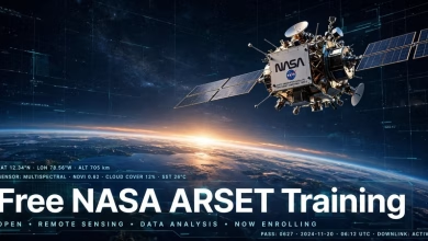
NASA ARSET is the Applied Remote Sensing Training program from NASA. It teaches you to work with free satellite data — air quality, floods, agriculture, water resources, and climate. Trainings run as live webinars and self-paced sessions, and you get a certificate when you finish.
ARSET is the best free option if you want remote sensing on your resume. It teaches the data itself, not just one software package. Our free NASA ARSET training guide covers the current training calendar and enrollment steps.
Start here: earthdata.nasa.gov — ARSET
2. IIRS / ISRO Outreach — Free Live Remote Sensing Courses From India
The Indian Institute of Remote Sensing (IIRS), part of ISRO, runs a free outreach program of live and interactive remote sensing courses. The sessions are taught by experts from ISRO and partner institutions, and the official page states plainly: there is no course fee, it is absolutely a free of cost program.
Courses cover remote sensing, GIS, and GNSS for students, faculty, researchers, and government staff. You earn a certificate based on 70% attendance and an online exam for students, or 70% attendance and assignments for working professionals. Over 120,000 participants from more than 1,000 institutions have joined so far.
Enrollment runs through your university or institute, which registers as an outreach network node. Ask your department coordinator to nominate you, or check the official page for the next course schedule.
Start here: elearning.iirs.gov.in — IIRS Outreach Programme
3. NPTEL / IIT Bombay — Remote Sensing: Principles and Applications
This 12-week course from IIT Bombay, offered through NPTEL, is the deepest free remote sensing course on this list. It covers electromagnetic radiation, sensors, image acquisition, spectral indices, thermal and microwave remote sensing, LiDAR, and real applications like land use monitoring and water resources management. There are no prerequisites.
The course content is free to learn. A certificate is available through NPTEL’s proctored exam, which carries a small exam fee — the learning itself costs nothing. Taught by Prof. Eswar Rajasekaran, Department of Civil Engineering, IIT Bombay.
Start here: onlinecourses.nptel.ac.in — Remote Sensing: Principles and Applications
4. UNSW — Remote Sensing Image Acquisition, Analysis, and Applications
The University of New South Wales offers a free online course on how remote sensing images are acquired, analyzed, and applied. It covers the fundamental nature of remote sensing, platforms, and sensor types, and it is listed in the IEEE Geoscience and Remote Sensing Society directory of free learning resources.
This is a strong pick if you want the science behind the pixels — how sensors work, what each band measures, and how analysts turn raw imagery into maps. Find it in the IEEE GRSS external education resources directory.
Start here: grss-ieee.org — External Educational Resources
5. ESA Academy and Geo University — More Free Earth Observation Learning
ESA Academy runs free training courses on Earth observation, and Geo University offers free GIS and Earth observation courses with possible certification. Both are listed in the same IEEE GRSS directory as the UNSW course, and both are worth checking when you finish the courses above.
These are best as second-step learning. Start with ARSET or IIRS for structure, then use ESA Academy material to go deeper into a single sensor or application.
Start here: grss-ieee.org — External Educational Resources
6. Coursera — Audit University Remote Sensing Courses for Free
Coursera hosts university remote sensing courses you can audit for free. You watch the same video lectures as paying students and pay only if you want a verified certificate. Search Coursera for remote sensing and choose “Audit the course” at enrollment.
Auditing is the cheapest way to get a university-style remote sensing education. The certificate costs extra, so audit first and pay only when a verified certificate matters for a job application.
Which Free Remote Sensing Course Should You Take First?
Complete beginner: start with NASA ARSET. The trainings are short, practical, and built around real satellite data, and you get a certificate when you finish.
Want a structured classroom course: join an IIRS / ISRO outreach course through your university. Live expert sessions plus a certificate make it the closest thing to a free university class.
Want deep theory for research or a degree: take the NPTEL / IIT Bombay course. Twelve weeks of physics, sensors, and applications will carry you through graduate-level work.
Already know GIS and want imagery skills: pair ARSET with the UNSW course, then practice on free Landsat and Sentinel data. Our Esri free MOOC guide also lists free imagery courses that include temporary ArcGIS access.
Need a certificate fast: ARSET and IIRS give certificates on completion. NPTEL certificates need the proctored exam, so plan for the next exam window.
Browse Free NASA ARSET Trainings — Official Site
Frequently asked questions
Are there really free remote sensing courses online?
Yes. NASA ARSET, IIRS / ISRO Outreach, the NPTEL / IIT Bombay course, and the UNSW course in this guide all cost $0 to learn. None of them needs a credit card to enroll.
Which free remote sensing course gives a certificate?
NASA ARSET and IIRS / ISRO Outreach both give certificates on completion. NPTEL gives a certificate through its proctored exam, which carries a small exam fee. Coursera lets you audit for free but charges for a verified certificate.
Can I learn remote sensing without a degree?
Yes. None of the courses in this guide requires a degree. ARSET and IIRS are open to students, professionals, and self-learners, and the NPTEL course lists no prerequisites.
Do I need paid software to take these courses?
No. Most courses teach with free data and free tools. Practice with QGIS and ESA SNAP, both free, and download free Landsat and Sentinel imagery while you learn.
How long does it take to learn remote sensing?
You can learn the basics — reading imagery, NDVI, and simple classification — in three to four weeks. Job-ready skills in image processing and analysis take three to six months, including a small portfolio of maps.
Is the NPTEL remote sensing certificate free?
The course content is free to learn, but the certificate comes through NPTEL’s proctored exam, which has a small exam fee. If you only need the knowledge, the course itself costs nothing.
Learning remote sensing costs nothing to start. Pick one course from this guide, finish it this month, and add the certificate to your resume. NASA ARSET builds practical satellite-data skills, IIRS gives you a structured classroom, and NPTEL builds the deep theory behind every image. Start with the course that matches your goal, and keep going until you can turn raw satellite imagery into maps employers understand.
Related posts: Free NASA ARSET Training · Esri Free MOOC · Free Udemy GIS Courses · Free GIS Software for Mac
Disclosure: Some links on this page are affiliate links. If you buy a book through them, CartoGeek may earn a small commission at no extra cost to you. This helps keep our GIS guides free for students. Thank you for your support!
Recommended Remote Sensing Books

Introductory Digital Image Processing: A Remote Sensing Perspective (4th Edition)
by John R. Jensen
The standard university textbook on digital image processing of satellite and aerial imagery, covering how to extract biophysical information from remote sensor data. Extensively illustrated with a substantive reference list in every chapter for students starting research projects.
Pros:
- The definitive textbook — used in remote sensing courses worldwide
- Deep coverage from theory to analytical methods
- Strong reference lists for further study
Cons:
- Expensive textbook pricing
- Heavy on theory — not a software click-by-click guide

Remote Sensing and Image Interpretation (7th Edition)
by Thomas Lillesand, Ralph W. Kiefer, Jonathan W. Chipman
A discipline-neutral classic for introductory remote sensing and image interpretation courses, valued by GIS students and practitioners alike. Clear explanations of technical concepts with color imagery placed to support learning.
Pros:
- Trusted classic — decades of classroom use
- Discipline-neutral, suits geography, forestry, planning and more
- Good as both textbook and professional reference
Cons:
- Print quality varies by printing
- Some digital editions have limited e-reader compatibility